

- Usage in publication:
-
- South Baldy Peak andesite†
- Modifications:
-
- Abandoned
Summary:
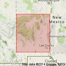
South Baldy Peak andesite--type locality South Baldy, the highest peak in the Magdalena Range, approximately 10 mi south of Magdalena, sec 6, T4S, R3W, South Baldy 7 1/2 min quad, Socorro Co, NM in Orogrande basin--abandoned in this report. Abandoned because unit as defined included andesites of the Sawmill Canyon Formation (eastern two thirds of outcrop area)--a new name in this report--and andesites above South Canyon Tuff, which are probably correlative with tongue d of La Jara Peak Basaltic Andesite (western one third of area). These rocks shown as Oligocene based on stratigraphic position. ["South Baldy Peak andesite" was first used by Krewedl, 1974, NM Bureau of Mines Open-File 44; this report is not on the computer.] Stratigraphic chart.
Source: GNU records (USGS DDS-6; Denver GNULEX).
For more information, please contact Nancy Stamm, Geologic Names Committee Secretary.
Asterisk (*) indicates published by U.S. Geological Survey authors.
"No current usage" (†) implies that a name has been abandoned or has fallen into disuse. Former usage and, if known, replacement name given in parentheses ( ).
Slash (/) indicates name conflicts with nomenclatural guidelines (CSN, 1933; ACSN, 1961, 1970; NACSN, 1983, 2005, 2021). May be explained within brackets ([ ]).