- Usage in publication:
-
- Souris Valley beds
- Modifications:
-
- Named
- AAPG geologic province:
-
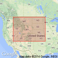
- Williston basin
Summary:
An informal subdivision of the Madison Group in northeast part of Williston basin, ND, Saskatchewan, and Manitoba based on correlation of widespread mechanical-log marker horizons. Named for beds between 3,632 ft and 4,210 ft in the Souris Valley Oil Company, Gordon White no. 1 well, Lsd. 5, sec 14, T1, R28, West 1st Meridian, Manitoba. Lower boundary top of the upper shale of the Bakken Formation; upper boundary the top of a 50-ft thick series of argillaceous limestone beds which form characteristic features on the spontaneous-potential log. Overlain by the Tilston beds (new). Correlation shown in four cross sections in Saskatchewan, Manitoba, and ND. Type well shown in one of the cross sections. Mississippian in age.
Source: GNU records (USGS DDS-6; Denver GNULEX).
For more information, please contact Nancy Stamm, Geologic Names Committee Secretary.
Asterisk (*) indicates published by U.S. Geological Survey authors.
"No current usage" (†) implies that a name has been abandoned or has fallen into disuse. Former usage and, if known, replacement name given in parentheses ( ).
Slash (/) indicates name conflicts with nomenclatural guidelines (CSN, 1933; ACSN, 1961, 1970; NACSN, 1983, 2005, 2021). May be explained within brackets ([ ]).

