The National Geologic Map Database is migrating to a new infrastructure. We apologize for any service disruptions during this process.
|
|---|


- Usage in publication:
-
- Soquel member*
- Modifications:
-
- Original reference
- Dominant lithology:
-
- Sandstone
- AAPG geologic province:
-
- Los Angeles basin
- Mojave basin
Summary:
Soquel member of Puente formation. Consists mainly of massive to moderately well bedded coarse-grained to gritty feldspathic sandstone. Maximum exposed thickness about 2,500 feet. Underlies Yorba member (new) with contact gradational throughout most of Puente Hills; where Yorba member is missing, Sycamore Canyon member rests on Soquel. In Carbon Canyon, the Soquel overlies La Vida member (new), contact gradational; south of Pomona, the Soquel overlaps older rocks and rests directly on the basement complex; south of Santiago Creek, the Soquel is locally unconformable successively on La Vida member, Topanga formation, and Sespe and Vaqueros formations, undivided. Age is late Miocene.
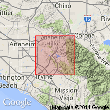
Named from the canyon that lies north of Telegraph Canyon and joins Carbon Canyon near the boundary between secs. 10 and 11, T. 3 S., R. 9 W., in southern part of Puente Hills, [Yorba Linda 7.5-min quadrangle, Orange Co.], southern CA (see Woodford and others, 1944, USGS Oil and Gas Prelim. Map OM-23).
Typical exposures are in Carbon Canyon from Gilman Peak north 1.5 mi to vicinity of Carbon Canyon Mineral Springs, [Yorba Linda 7.5-min quadrangle, Orange, Los Angeles, and San Bernardino Cos.], southern CA.
Source: Publication; US geologic names lexicon (USGS Bull. 1200, p. 3663).
For more information, please contact Nancy Stamm, Geologic Names Committee Secretary.
Asterisk (*) indicates published by U.S. Geological Survey authors.
"No current usage" (†) implies that a name has been abandoned or has fallen into disuse. Former usage and, if known, replacement name given in parentheses ( ).
Slash (/) indicates name conflicts with nomenclatural guidelines (CSN, 1933; ACSN, 1961, 1970; NACSN, 1983, 2005, 2021). May be explained within brackets ([ ]).