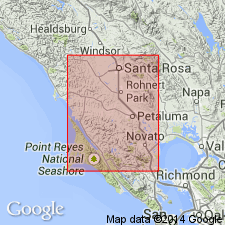
- Usage in publication:
-
- Sonoma group
- Modifications:
-
- Original reference
- AAPG geologic province:
-
- Northern Coast Range province
Summary:
Sonoma group. Basalts, andesites, rhyolites, tuff-breccia, fine-grained tuff, and other agglomerates. Generalized section running north from Adobe Fort to Petaluma Reservoir shows following sequence (descending): basalt, tuff, basalt, conglomerate, basalt, NEOHIPPARION GIDLEYI beds, and tuff, resting unconformably on Petaluma formation. Includes Sonoma tuff, Mark West andesite, and St. Helena rhyolite of Osmont. Is overlain by Millerton formation. In Pinole syncline is known as Pinole tuff. The tuffaceous facies of Sonoma group are represented as interbedded tuff members of marine Merced group. Age is Pliocene.
Named from typical exposures on west flanks of Sonoma Mountains, north of San Francisco Bay region, Sonoma Co., northern CA.
Source: US geologic names lexicon (USGS Bull. 896, p. 2026-2027).
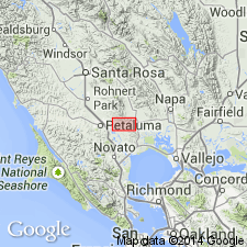
- Usage in publication:
-
- Sonoma volcanics
- Modifications:
-
- Revised
- AAPG geologic province:
-
- Northern Coast Range province
Summary:
Pg. 1437-1455. Sonoma volcanics overlie, with angular unconformity, Petaluma formation in Petaluma district and are probably = Merced formation. NEOHIPPARION GIDLEYI occurs in Petaluma formation, and not in Sonoma group. [On map the Sonoma is assigned to upper or middle Pliocene; but in text authors seem to incline to middle Pliocene.]
Source: US geologic names lexicon (USGS Bull. 896, p. 2026-2027).
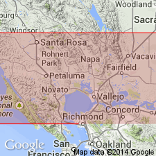
- Usage in publication:
-
- Sonoma volcanics*
- Modifications:
-
- Revised
- AAPG geologic province:
-
- Northern Coast Range province
Summary:
Pg. 110 (table 24), 118, 122-128, pls. 6-7, 10-12 (geol. maps). Name Sonoma volcanics is used for a complex series of lava flows and tuff beds that in some areas are interbedded with sandstone, gravel, and conglomerate. Lava flows which constitute more than 60 percent of entire sequence are prevaillingly andesitic but in many places approach basalt. Includes St. Helena rhyolite member which forms upper part of sequence. Dickerson (1922) used name Sonoma group to include original Sonoma tuff, Mark West andesite, and St. Helena rhyolite. Detailed studies show that entire sequence beneath St. Helena rhyolite member, including the "Mark West andesite," varies greatly from place to place; hence, the sequence is regarded as a single geologic unit. Lavas and tuffs of the Sonoma volcanics, excluding the St. Helena rhyolite member, are exposed over an area of more than 350 square miles. Thickness in Howell Mountains, exclusive of St. Helena rhyolite, about 1,290 feet. Unconformably overlies San Pablo, Petaluma, and older formations; in some areas, interfingers with Merced formation. Volcanics were involved in folding which preceded Pleistocene deposition. Patches of lava exposed west of Tolay Creek near Lakeville School were regarded as outcrops of Tolay volcanics by Morse and Bailey (1935). There are here mapped as part of Sonoma volcanics. Area of report is the coast ranges north of San Francisco Bay region, northern California. Age is Pliocene.
Source: US geologic names lexicon (USGS Bull. 1200, p. 3660-3661).
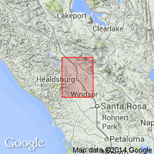
- Usage in publication:
-
- Sonoma group
- Modifications:
-
- Revised
- AAPG geologic province:
-
- Northern Coast Range province
Summary:
Pg. 11 (fig. 2), 22-24, pls. 1, 3. Sonoma group. Described in Healdsburg quadrangle as Sonoma group. Includes heterogeneous series of lava flows, agglomerates, and tuffs interbedded with nonmarine conglomerate, sandstone, and clay. Maximum thickness 4,000 feet (on east limb of Windsor syncline). Overlies faulted, folded Mesozoic rocks; nonmarine Sonoma sands and gravels grade into Merced formation. Age is Pliocene.
Source: US geologic names lexicon (USGS Bull. 1200, p. 3660-3661).
- Usage in publication:
-
- Sonoma volcanics*
- Modifications:
-
- Revised
- AAPG geologic province:
-
- Northern Coast Range province
Summary:
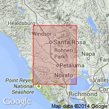
Pg. 27 (table 6), 35-58, pl. 1. Sonoma volcanics described in Santa Rosa and Petaluma Valleys. Exposures are restricted mainly to eastern part of area where they have been intensely folded and faulted to form Sonoma and Mayacmas Mountains. On southwestern flanks of Sonoma Mountains, volcanics are in depositional contact with underlying Petaluma formation. Underlie and interfinger with Merced formation. In vicinity of Petaluma, the volcanics, for most part, directly overlie Fanciscan group, although individual flows may be intercalated with Merced formation. Underlie Glen Ellen formation, locally some interbedding occurs. Where not overlain by Glen Ellen, volcanics dip beneath alluvium at valley margins. Thickness 0 to about 2,000 feet. Includes lower part of Sonoma group of Gealey (1950 [1951]). Tolay volcanics of Morse and Bailey (1935) are mapped with Sonoma. Age is Pliocene.
Source: US geologic names lexicon (USGS Bull. 1200, p. 3660-3661).
- Usage in publication:
-
- Sonoma volcanics*
- Modifications:
-
- Overview
- AAPG geologic province:
-
- Northern Coast Range province
Summary:
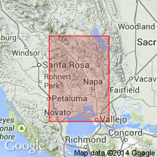
Pg. 15-25. Sonoma volcanics. As defined and exposed in Napa and Sonoma Valleys. Sonoma volcanics constitute thick and highly variable series of continental volcanic rocks, including andesite, basalt, and minor rhyolite flows with interbedded coarse- to fine-grained pyroclastic tuff and breccia, redeposited tuff and pumice, and diatomaceous mud, silt, and sand; also a prominent body of rhyolite flows and tuff with some obsidian and perlitic glass. Unconformably overlie Neroly sandstone of Miocene age, and St. Helena rhyolite member underlies with some unconformity the Huichica formation of supposed Pleistocene age. Age is Pliocene.
Source: US geologic names lexicon (USGS Bull. 1200, p. 3660-3661).
- Usage in publication:
-
- Sonoma Volcanics*
- Modifications:
-
- Geochronologic dating
- AAPG geologic province:
-
- Northern Coast Range province
Summary:
Pg. 8, geologic time scale (inside front cover). Sonoma Volcanics. Tuff sample from pumice-lapilli tuff, in pumice quarry about 90 m southwest of BM428, Lat. 38 deg. 15 min. 14 sec. N., Long. 122 deg. 08 min. 15 sec. W., Mount George quadrangle, Solano County, California, yielded a K-Ar age of 4.16 +/-0.41 Ma (plagioclase). Age agrees with other ages on tuff in region (Sarna-Wojcicki, 1976, USGS Prof. Paper 972). Sample from a 37 m-thick ash-flow tuff, in long roadcut on frontage road, west side of CA Highway 21, about 61 m east of VABM-Goodyear 212, Lat. 38 deg. 06 min. 24 sec. N., Long. 122 deg. 06 min. 08 sec. W., Port Chicago quadrangle, Solano County, California, yielded a K-Ar age of 3.33 +/-0.23 (plagioclase). Plagioclase concentrate from pumice bombs gave an age younger than other ages from tuffs of west-central CA (Sarna-Wojcicki, 1976). Ages calculated using decay constants of Steiger and Jager, 1977 (Earth Planet. Sci. Letters, v. 36, p. 359-362). [Pliocene, based on time scale of Berggren, 1972, Lethaia, v. 5, no. 2, p. 195-215.]
Source: Publication.
For more information, please contact Nancy Stamm, Geologic Names Committee Secretary.
Asterisk (*) indicates published by U.S. Geological Survey authors.
"No current usage" (†) implies that a name has been abandoned or has fallen into disuse. Former usage and, if known, replacement name given in parentheses ( ).
Slash (/) indicates name conflicts with nomenclatural guidelines (CSN, 1933; ACSN, 1961, 1970; NACSN, 1983, 2005, 2021). May be explained within brackets ([ ]).

