- Usage in publication:
-
- Sombrero Member
- Modifications:
-
- Named
- Dominant lithology:
-
- Fanglomerate
- Sand
- AAPG geologic province:
-
- Basin-and-Range province
Summary:
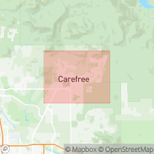
Named as member of Carefree Formation (new). Named for Sombrero Rd. Type locality is northern wall of roadcut at junction of Sombrero and Cow Track Rds, Cave Creek quad, northern Maricopa Co, central AZ. First described by Kenny (1986). Exposed as northeast-southwest-trending ridges and valleys in north-central part of Carefree basin, west and southwest of Lone Mountain, covering approx 7.5 sq mi, and under Quaternary veneer deposits. Described as light-gray, moderately consolidated, blocky fanglomerate in silty-sand matrix, poorly sorted, characterized by meta-argillite-basalt composition and lack of well-defined bedding. Few wells drilled. Ridge-valley relief measures maximum thickness at 160 feet. Basin cross sections show a possible 200 to 300 feet. Overlies and interfingers late Miocene and early Pliocene Grapevine Member to south and southwest and laterally interfingers with Naked Girl Canyon Member to northwest, (both new) of Carefree Formation. Underlies Pleistocene Horny Toad Terrace deposits (new, [informal]), Pleistocene Schoolhouse Glacis Alluvium, Desert Mountain Glacis Alluvium, and Holocene Vermeersch Alluvium (all new). Age is late Miocene and early Pliocene based on constraining minimum radiometric date of <13.4 Ma of White Eagle Mine Formation (new). Report includes geologic map and cross section, and stratigraphic nomenclature table.
Source: GNU records (USGS DDS-6; Denver GNULEX).
For more information, please contact Nancy Stamm, Geologic Names Committee Secretary.
Asterisk (*) indicates published by U.S. Geological Survey authors.
"No current usage" (†) implies that a name has been abandoned or has fallen into disuse. Former usage and, if known, replacement name given in parentheses ( ).
Slash (/) indicates name conflicts with nomenclatural guidelines (CSN, 1933; ACSN, 1961, 1970; NACSN, 1983, 2005, 2021). May be explained within brackets ([ ]).

