The National Geologic Map Database is migrating to a new infrastructure. We apologize for any service disruptions during this process.
|
|---|


- Usage in publication:
-
- Soledad member
- Modifications:
-
- Original reference
- Dominant lithology:
-
- Tuff
- Conglomerate
- Sandstone
- AAPG geologic province:
-
- Gulf Coast basin
Summary:
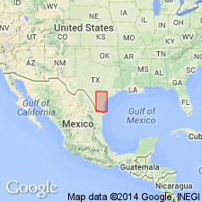
Pg. 65, 80-89, 178-179. Soledad member of Gueydan formation. Interbedded friable grayish-pink trachyandesite or acid andesite tuffs, pumice-pebble conglomerates or lapilli beds, coarse to fine volcanic conglomerates and volcanic sandstones and tuffaceous sandstones. Middle member of Gueydan formation. [Thicknesses in sections 33 and 55 feet.] Underlies, conformably, Chusa member of Gueydan formation, and overlies Fant member of Gueydan. Assigned to Oligocene because it correlates with lower part of Catahoula sandstone.
Named for fact Soledad Hills, in western Duval Co., southwestern TX coastal plain, are composed of this member.
Source: US geologic names lexicon (USGS Bull. 896, p. 2023).

- Usage in publication:
-
- Soledad volcanic conglomerate member*
- Modifications:
-
- Overview
- AAPG geologic province:
-
- Gulf Coast basin
Summary:
Soledad volcanic conglomerate member of Catahoula tuff. Age is early Miocene or Oligocene. Recognized in southwestern Texas Coastal Plain. The Gueydan formation is same as Catahoula tuff, and "Gueydan" has been discarded by both Texas Geol. Survey and USGS.
Source: US geologic names lexicon (USGS Bull. 896, p. 2023).

- Usage in publication:
-
- Soledad Volcanic Conglomerate Member*
- Modifications:
-
- Mapped 1:250k
- Dominant lithology:
-
- Conglomerate
- Volcanics
- AAPG geologic province:
-
- Gulf Coast basin
Summary:
Soledad Volcanic Conglomerate Member of Catahoula Formation. Abundant pebbles, cobbles, and boulders up to a foot in size, of rhyolitic, trachytic, and trachyandesitic composition, loosely to moderately cemented, mottled gray. Thickness up to 75 feet. Is middle member of Catahoula Formation. Lies above Fant Tuff Member and below Chusa Tuff Member (both of Catahoula). Age is Miocene.
[Mapped in northwestern Duval Co., southern TX.]
Source: Publication.
For more information, please contact Nancy Stamm, Geologic Names Committee Secretary.
Asterisk (*) indicates published by U.S. Geological Survey authors.
"No current usage" (†) implies that a name has been abandoned or has fallen into disuse. Former usage and, if known, replacement name given in parentheses ( ).
Slash (/) indicates name conflicts with nomenclatural guidelines (CSN, 1933; ACSN, 1961, 1970; NACSN, 1983, 2005, 2021). May be explained within brackets ([ ]).