

- Usage in publication:
-
- Soldier Cap Olivine Basalt
- Modifications:
-
- Named
- Dominant lithology:
-
- Basalt
- Ash
- AAPG geologic province:
-
- Snake River basin
Summary:
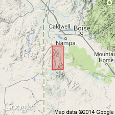
Named for a butte called Soldier Cap; type section designated on east side of north-south-trending ridge south-southwest of Soldier Cap, Owyhee Co, ID, Snake River basin, where attains a maximum thickness of 885 ft. Is one of eight units of Reynolds Basin Group (new), which is of late Miocene or early Pliocene age. Highly resistant to weathering. Basalt forms bold ledge outcrops that project above aprons of coarse angular talus. Weathered rock is dark brown and often has a glossy patina. Some joint planes coated with hyalite. Parallel flow banding apparent on some specimens. Vertical joints may be spaced as widely as 3 ft; they are not parallel--each joint curves broadly and intersects its neighbor when followed up face of a ledge. Highly vesicular zones are encountered within flows as well as at flow contacts. Fresh rock is medium dark gray and contains numerous very tiny reddish-brown specks of altered olivine that tend to give rock a purplish or reddish hue. Very fine grained and almost invariably nonporphyritic. Typically contains iddingsitized olivine and plagioclase microphenocrysts in a pilotaxitic groundmass. Red welded ash zones occur interstratified with Soldier Cap flows. Thickest portion of unit is in northeast, thins to southwest, where it interfingers with Hoot Nanny Olivine Basalt (new), also of Reynolds Basin Group. In some places, lies directly on granitic rock.
Source: GNU records (USGS DDS-6; Denver GNULEX).
For more information, please contact Nancy Stamm, Geologic Names Committee Secretary.
Asterisk (*) indicates published by U.S. Geological Survey authors.
"No current usage" (†) implies that a name has been abandoned or has fallen into disuse. Former usage and, if known, replacement name given in parentheses ( ).
Slash (/) indicates name conflicts with nomenclatural guidelines (CSN, 1933; ACSN, 1961, 1970; NACSN, 1983, 2005, 2021). May be explained within brackets ([ ]).