- Usage in publication:
-
- Socorro Peak Rhyolite
- Modifications:
-
- Named
- Dominant lithology:
-
- Rhyodacite
- Rhyolite
- AAPG geologic province:
-
- Orogrande basin
Summary:
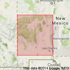
Named for Socorro Peak and vicinity. Type area (described in an open file report repeated here) is approximately 3 mi west and southwest of Socorro in a belt extending from Socorro Peak summit south to Grefco perlite mine, secs 5, 8, 16, 21, 28, T3N, R1W, Socorro Co, NM, Orogrande basin. Consists of rhyodacite and rhyolite domes and flows with minor pyroclastic rocks. Domes have been dated as 12.1 +/-0.5 m.y. (Strawberry Peak), 4.5 +/-1.0 m.y. (Radar Peak), 10.8 +/-0.4 m.y. (Signal Flag Hill), 10.6 +/-1.5 m.y. (Stonewall Hill), 10.3 +/-0.5 m.y. (6001 Mesa), 9.2 +/-0.4 m.y. (.6633 Peak) -K-Ar method. Includes rhyolite of Pound Ranch. Overlies Popotosa fanglomerate and playa mudstones and interbedded with upper Popotosa mudstone. Originated from numerous vents in Socorro Peak area. Miocene age.
Source: GNU records (USGS DDS-6; Denver GNULEX).
For more information, please contact Nancy Stamm, Geologic Names Committee Secretary.
Asterisk (*) indicates published by U.S. Geological Survey authors.
"No current usage" (†) implies that a name has been abandoned or has fallen into disuse. Former usage and, if known, replacement name given in parentheses ( ).
Slash (/) indicates name conflicts with nomenclatural guidelines (CSN, 1933; ACSN, 1961, 1970; NACSN, 1983, 2005, 2021). May be explained within brackets ([ ]).

