The National Geologic Map Database is migrating to a new infrastructure. We apologize for any service disruptions during this process.
|
|---|


- Usage in publication:
-
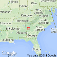
- Soapstone Ridge Complex*
- Modifications:
-
- Named
- Dominant lithology:
-
- Amphibolite
- Schist
- AAPG geologic province:
-
- Piedmont-Blue Ridge province
Summary:
The Soapstone Ridge Complex is here named in the Newnan-Tucker synform near Atlanta, GA. It is composed of metamorphosed mafic and ultramafic igneous rocks and is divided into six major lithologic units: basal sillimanite-quartz blastomylonite and epidosite, actinolite-chlorite-talc schist, interlayered metamorphosed mafic and ultramafic rocks, mixed amphibolite and actinolite-chlorite-talc schist, amphibolite, and metatroctalite. It is a multiply folded thrust sheet nowhere more than 200 m thick, with many erosional windows exposing rocks of the Big Cotton Indian Formation of the Atlanta Group. The Complex is a remnant of a disrupted ophiolite complex, emplaced by low-angle thrusting onto the Atlanta Group in early Middle Ordovician time. Age is early Paleozoic (?).
Source: GNU records (USGS DDS-6; Reston GNULEX).

- Usage in publication:
-
- Soapstone Ridge Complex†
- Modifications:
-
- Abandoned
- AAPG geologic province:
-
- Piedmont-Blue Ridge province
Summary:
Field mapping during 1992 of Soapstone Ridge area indicated that the area thought to be underlain by a mafic-ultramafic complex (Soapstone Ridge Complex) is actually underlain by Paulding Volcanic-Plutonic Complex with an abundance of mafic and ultramafic blacks and slabs and that rocks of the Paulding are surrounded by Stonewall Gneiss like a sheath. Plunges of minor fold axes, mineral elongations, crenulations, and other lineations are consistently eastward at 20 to 30 degrees in both Paulding and Stonewall; it appears that Paulding and Stonewall occupy a sheath fold, with Paulding being the "knife" in the fold. Because rocks previously designated Soapstone Ridge Complex belong to the Paulding, the name Soapstone Ridge Complex is abandoned. Report includes geologic amp and correlation chart.
Source: GNU records (USGS DDS-6; Reston GNULEX).
For more information, please contact Nancy Stamm, Geologic Names Committee Secretary.
Asterisk (*) indicates published by U.S. Geological Survey authors.
"No current usage" (†) implies that a name has been abandoned or has fallen into disuse. Former usage and, if known, replacement name given in parentheses ( ).
Slash (/) indicates name conflicts with nomenclatural guidelines (CSN, 1933; ACSN, 1961, 1970; NACSN, 1983, 2005, 2021). May be explained within brackets ([ ]).