The National Geologic Map Database is migrating to a new infrastructure. We apologize for any service disruptions during this process.
|
|---|


- Usage in publication:
-
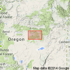
- Snowshoe formation
- Modifications:
-
- Original reference
- Dominant lithology:
-
- Sandstone
- AAPG geologic province:
-
- Snake River basin
Summary:
Pg. 227 (table 1), 229, 259-263. Snowshoe formation. Consists of approximately 2,800 feet of black shale and fine-grained, dark-gray, laminated sandstone in the upper part of Izee group. Unconformably underlies Trowbridge shale (new); overlies Hyde formation (new). Age is Middle Jurassic.
Type area: on southeast limb of Mowich anticline; exposures lie in narrow belt extending from Snow Mountain northeastward across South Fork Valley, Crook Co., east-central OR. Named from the "Snowshoe country" on headwaters of Silvies River.
Source: US geologic names lexicon (USGS Bull. 1200, p. 3646-3647).
- Usage in publication:
-
- Snowshoe formation
- Modifications:
-
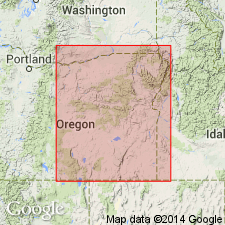
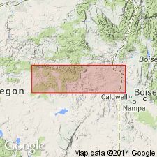
- Areal extent
- AAPG geologic province:
-
- Snake River basin
Summary:
Weberg, Warm Springs, and Basey (new) formations are lateral equivalents of Snowshoe formation.
Source: US geologic names lexicon (USGS Bull. 1200, p. 3646-3647).
- Usage in publication:
-
- Snowshoe Formation*
- Modifications:
-
- Biostratigraphic dating
- Overview
- AAPG geologic province:
-
- Snake River basin
Summary:
Pg. C7, C10 (fig. 3), C11 (fig. 4), C12-C15 (table 3), C14, C16 (fig. 5). The Snowshoe Formation of Lupher (1941) is about 3,000-3,500 feet thick and consists mostly of dark-gray to black, thin-bedded, volcanic mudstone, siltstone, and sandstone. These pass laterally in part into andesitic marine tuff and volcanic graywacke (Dickinson, 1962, p. 483; Dickinson and Vigrass, 1965, p. 44-46, 58-60). The basal 125 feet is remarkably similar lithologically to the Nicely Shale. This similarity includes the presence of black limestone concretions that weather light-gray. The megafossils found in the basal part of the Snowshoe Formation consist mostly of ammonites and the pelecypod BOSITRA BUCHI (Roemer). With the ammonites in some concretions have been found some small nondescript oysters. Otherwise, bottom-dwelling pelecypods are absent.
In east-central Oregon, near Izee and Seneca, late Toarcian ammonites were obtained from the basal 125 feet of the formation. DUMORTIERIA(?) recovered from near the base of formation, in west bank of Wickiup Creek (USGS Mesozoic fossil locs. 25823, 28030, 29216, 29217). HAUGIA recovered from about 75 feet above base, in bed of Flat Creek, just east of Big Flat (USGS Mesozoic fossil loc. 26750 and Lupher's loc. 127). CATULLOCERAS recovered from about 100 to 125 feet above the base, in roadcut on divide between Sheep Creek and Hole-in-the-Ground (USGS Mesozoic fossil locs. 26751, 25690, and Lupher's loc. 76). An early Bajocian ammonite TMETOCERAS recovered from 125 to 200 feet above base is evidence that only a small part (basal 4 to 5 percent) of the formation is of late Toarcian age. Report includes correlation charts, fossil plates, maps showing fossil localities, charts showing distribution of ammonite genera and species.
See also:
Dickinson, W.R., 1962, "Petrology and diagenesis of Jurassic andesitic strata in central Oregon," Amer. Jour. Sci., v. 260, p. 481-500.
Dickinson, W.R., and Vigrass, L.W., 1965, "Geology of the Suplee-Izee area, Cook, Grant, and Harney Counties, Oregon," Oregon Dept. Geol. and Min. Ind. Bull., no. 58, 109 p., geol. map (scale 1:42,000).
Source: Publication.
- Usage in publication:
-
- Snowshoe Formation
- Modifications:
-
- Overview
- AAPG geologic province:
-
- Snake River basin
Summary:
Pg. 48-49. Snowshoe Formation. Defined by Lupher (1941) who designated type [area] as band of exposures extending northeastward from Snow Mountain across South Fork Valley on southeast limb of Mowich anticline. Is widespread in Suplee-Izee district, central Oregon. West of type [area], Dickinson and Vigrass (1965) included Weberg Member (Weberg Formation of Lupher, 1941), Warm Springs Member (Warm Springs Formation of Lupher, 1941), Basey Member (Hyde Formation of Lupher, 1941), and Shaw member (informal) in the Snowshoe Formation.
In vicinity of type [area], the Snowshoe consists of 2,750 feet of dark lutites with intercalations of fine-grained sandstone and thick-bedded, calcareous sandstone in the middle and top, respectively. Divided into unnamed lower, middle, and upper members by Dickinson and Vigrass (1965). Lower member consists of 600 feet of soft, dark-gray to black, thin-bedded mudstone, siltstone and shale; contains abundant radiolarians. Locally is calcareous and exhibits platy parting. Middle member consists of 1,000 feet of dark-gray to black lutite interlaminated with coarser beds of graded volcaniclastics; lacks radiolarians. Grades westward into Basey Member and eastward into Silvies Member. Upper member consists of 1,250 feet of thin-bedded, dark mudstone and siltstone with thick interbeds of gray calcareous sandstone. Increases in thickness to 1,500 to 2,000 feet east of Rosebud and Lewis Creeks; wedges out to the west under Trowbridge Formation.
In eastern part of Suplee-Izee district, Snowshoe Formation gradationally overlies Hyde Formation and is interpreted to be unconformable beneath Trowbridge; age is Middle Jurassic (early Toarcian through early Callovian). In western part of Suplee-Izee district, the Snowshoe unconformably overlies Mowich Group; age is somewhat younger where the Weberg Member is assigned an early middle Bajocian age.
See also:
Dickinson, W.R., and Vigrass, L.W., 1965, "Geology of the Suplee-Izee area, Cook, Grant, and Harney Counties, Oregon," Oregon Dept. Geol. and Min. Ind. Bull., no. 58, 109 p., geol. map (scale 1:42,000).
Imlay, R.W., 1964, "Upper Jurassic mollusks from eastern Oregon and western Idaho," USGS Prof. Paper 483-D, 21 p.
Source: Publication.
- Usage in publication:
-
- Snowshoe Formation*
- Modifications:
-
- Biostratigraphic dating
- Adopted
- AAPG geologic province:
-
- Snake River basin
Summary:
Snowshoe Formation of Lupher (1941) adopted as revised by Dickinson and Vigrass (1965). Overlies Hyde Formation of Lupher (1941); underlies Trowbridge Shale of Lupher (1941). Includes (ascending): in Suplee area, Weberg, Warm Springs, and Basey Members; in Izee area, unnamed lower member, unnamed middle member or Silvies Member (correlatives), and unnamed upper member; in Seneca area, undivided. Age is Middle Jurassic. Report includes detailed faunal lists, descriptions, map locations of Bajocian ammonites.
Source: Changes in stratigraphic nomenclature, 1973 (USGS Bull. 1395-A, p. A38-A39); supplemental information from GNU records (USGS DDS-6; Menlo GNULEX, Warm Springs entry).
For more information, please contact Nancy Stamm, Geologic Names Committee Secretary.
Asterisk (*) indicates published by U.S. Geological Survey authors.
"No current usage" (†) implies that a name has been abandoned or has fallen into disuse. Former usage and, if known, replacement name given in parentheses ( ).
Slash (/) indicates name conflicts with nomenclatural guidelines (CSN, 1933; ACSN, 1961, 1970; NACSN, 1983, 2005, 2021). May be explained within brackets ([ ]).