The National Geologic Map Database is migrating to a new infrastructure. We apologize for any service disruptions during this process.
|
|---|


- Usage in publication:
-
- Snowcaps Member*
- Modifications:
-
- Original reference
- Biostratigraphic dating
- Dominant lithology:
-
- Shale
- Limestone
- Siltstone
- AAPG geologic province:
-
- Great Basin province
Summary:
Pg. J5 (fig. 3), J18 (fig. 13), J21-J22, J38-J39. Snowcaps Member of Kearsarge Formation. Divided into (descending): (unit 5) black shale interbedded with 2 limestone debris-flow beds, 47 m thick; (unit 4) amalgamated limestone turbidites, 32.5 m thick; (unit 3) black shale and argillite that contain abundant horizontal grazing trails, 29 m thick; (unit 2) quartzose siltstone that weathers orangish brown, 18 m thick; and (unit 1) thick, graded, bioclastic limestone beds, 13.5 m thick. Total thickness 140 m. Is top member of Kearsarge Formation (new). Conformably underlies Rest Spring Shale; unconformably overlies Bee Member (new) of Kearsarge Formation. Present in northwestern-facies belt (base-of-slope and deep basinal environments), notably the Vaughn Gulch area, Inyo County, eastern California. Rocks previously included in Perdido Formation by some geologists. Age is Late Mississippian (Meramecian to early Chesterian; Lower CAVUSGNATHUS zone to BILINEATUS-Upper CAVUSGNATHUS zone of Poole and Sandberg (1991).
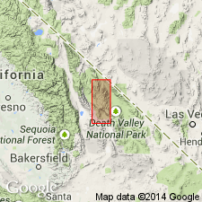
Type section (=type section of Kearsarge Formation): on ridge on south side of Vaughn Gulch, about 11.5 km east of Independence, west side of Inyo Mountains, [in NW/4 SW/4 sec. 9, T. 13 S., R. 36 E., approx. Lat. 36 deg. 49 min. 00 sec. N., Long. 118 deg. 04 min. 18 sec. W., Bee Springs Canyon 7.5-min quadrangle, 1994 ed.], Inyo Co., eastern CA. Named from Snowcaps Mine near mouth of Mazourka Canyon.
Source: Publication.
For more information, please contact Nancy Stamm, Geologic Names Committee Secretary.
Asterisk (*) indicates published by U.S. Geological Survey authors.
"No current usage" (†) implies that a name has been abandoned or has fallen into disuse. Former usage and, if known, replacement name given in parentheses ( ).
Slash (/) indicates name conflicts with nomenclatural guidelines (CSN, 1933; ACSN, 1961, 1970; NACSN, 1983, 2005, 2021). May be explained within brackets ([ ]).