

- Usage in publication:
-
- Snake River Group*
- Modifications:
-
- Revised
- AAPG geologic province:
-
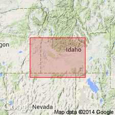
- Snake River basin
Summary:
Raised to group rank and includes, in ascending order, Madson Basalt (revised), Sugar Bowl Gravel (new), Thousand Springs Basalt (revised), Crowsnest Gravel (new), Sand Springs Basalt (revised), Bancroft Springs Basalt (new), Melon Gravel (new) and unnamed Recent lava flows. Consists of unaltered, water-bearing basalts of Snake River Plain, interbedded at some places with river deposits forming an assemblage of eight overlapping units. Basalts were extruded at various times during entrenchment of Snake River canyon. Type exposures of constituent units occur in east wall of canyon extending from Bliss to Thousand Springs (9 mi north to 5 mi south of Hagerman), Gooding Co, ID, Snake River basin. Group occurs mainly in eastern Snake River Plain. From type, basalts of group extend eastward and northeastward 250 mi along Snake River and into bordering plains to north and south. Maximum thickness at type is about 550 ft, though a composite thickness of individual units from local outcrops would be much thicker; based on drilling near Arco, Butte Co, ID (located about 100 mi northeast of Hagerman), group is at least 900 ft thick. Stratigraphic chart. Overlies Idaho Group (revised). Assigned late Pleistocene and Recent age based on fossil mollusks and mammals which have affinities with modern species.
Source: GNU records (USGS DDS-6; Denver GNULEX).
- Usage in publication:
-
- Snake River Group*
- Modifications:
-
- Revised
- AAPG geologic province:
-
- Snake River basin
Summary:
Snake River Group. Recognized in southern Idaho. Stratigraphic succession revised. Formations are (ascending): Madson Basalt, Sugar Bowl Gravel, Thousand Springs Basalt, Crowsnest Gravel, Sand Springs Basalt, Wendell Grade Basalt, McKinney Basalt, Melon Gravel, and locally, Holocene lava flows. Bancroft Springs Basalt abandoned; its rocks now part of McKinney Basalt. In southeastern Idaho the group also includes Big Hole Basalt. Age is late Pleistocene and Holocene.
Source: Publication; Changes in stratigraphic nomenclature, 1971 (USGS Bull. 1372-A, p. A18-A19).
- Usage in publication:
-
- Snake River Group*
- Modifications:
-
- Revised
- AAPG geologic province:
-
- Snake River basin
Summary:
New unit, Pleistocene Yahoo Clay, added to Snake River Group. Stratigraphic sequence within Snake River Group modified. Crowsnest Gravel, formerly thought to lie between Thousand Springs and Sand Springs Basalts, is now known to overlie Yahoo Clay and underlie Melon Gravel, in Snake River basin.
Source: GNU records (USGS DDS-6; Denver GNULEX).
- Usage in publication:
-
- Snake River Group*
- Modifications:
-
- Geochronologic dating
- AAPG geologic province:
-
- Snake River basin
Summary:
Two whole-rock K-Ar analyses yielded a mean age of 72,000 +/-14,000 yr B.P. age for the upper of two flows of the Cedar Butte Basalt of the Snake River Group in Snake River basin.
Source: GNU records (USGS DDS-6; Denver GNULEX).
- Usage in publication:
-
- Snake River Group*
- Modifications:
-
- Revised
- AAPG geologic province:
-
- Snake River basin
Summary:
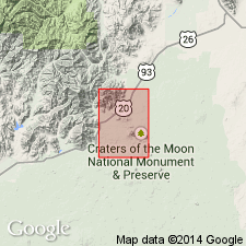
Snake River Group in mapped area is in the Craters of the Moon lava field in the Snake River basin and is divided into eruptive periods A (youngest) to H (oldest), and one unit of indeterminate age. Lava flows of eruptive periods H and G are of latest Pleistocene age. Lava flows of eruptive period E are Pleistocene to Holocene. Lava flows of the remaining eruptive periods--D, C, and A--are of Holocene age. Eruptive period B is not present in map area. Eruptive period H began about 15,000 yrs. ago. Eruptive period A ended about 2,000 yrs. ago. [No formal divisions of Snake River Group mapped in this quad.] The Craters of the Moon lava field consists of more than 93 lava flows and flow units, cinder cones, and eruptive fissure systems. Fifty-two units are present in this quad. The lava field covers an area of about 1,600 sq km, the largest dominantly Holocene volcanic field in the conterminous U.S. [See also adjoining maps--GQ-1633, -1634, and -1635.]
Source: GNU records (USGS DDS-6; Denver GNULEX).
For more information, please contact Nancy Stamm, Geologic Names Committee Secretary.
Asterisk (*) indicates published by U.S. Geological Survey authors.
"No current usage" (†) implies that a name has been abandoned or has fallen into disuse. Former usage and, if known, replacement name given in parentheses ( ).
Slash (/) indicates name conflicts with nomenclatural guidelines (CSN, 1933; ACSN, 1961, 1970; NACSN, 1983, 2005, 2021). May be explained within brackets ([ ]).