The National Geologic Map Database is migrating to a new infrastructure. We apologize for any service disruptions during this process.
|
|---|


- Usage in publication:
-
- Snake Hill Formation*
- Modifications:
-
- Overview
- AAPG geologic province:
-
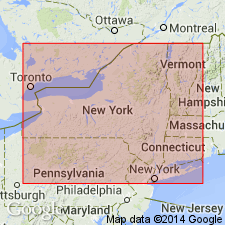
- New England province
Summary:
Snake Hill Shale of eastern New York correlates with Martinsburg Formation, which flanks the Reading Prong in New Jersey. Author states that thicknesses of the Snake Hill and Martinsburg have been grossly underestimated by previous workers. Table 2 shows correlation of lower Paleozoic rocks bordering Reading Prong with rocks in the Delaware Valley, NJ, and eastern NY, and their thicknesses. Thickness of Snake Hill shown as 3000 ft (914 m). [Although table 2 implies a Middle and Late Ordovician age for the Snake Hill, an age change probably was not intended, as reflected by GNC records.]
Source: GNU records (USGS DDS-6; Reston GNULEX).

- Usage in publication:
-
- Snake Hill Formation*
- Modifications:
-
- Overview
- Areal extent
- AAPG geologic province:
-
- New England province
Summary:
Paleozoic cover sequence adjacent to Adirondack massif in western part of Glens Falls quad consists of (ascending): Late Cambrian Potsdam Sandstone, Late Cambrian Ticonderoga Formation, Late Cambrian and Early Ordovician Beekmantown Group (with Whitehall Formation at base), early Middle Ordovician Chazy Group, Middle Ordovician Black River and Trenton Groups, and Mohawk Valley shales (Canajoharie Shale and Snake Hill Formation). Potsdam and Ticonderoga are partly correlative with Danby Formation of Middlebury synclinorium in VT. Beekmantown and part of Chazy correlate directly with limestones and dolomites above Danby. Paleozoic cover sequence is interpreted as a platform sequence. [Text states Beekmantown "as used by Fisher (1984)", but this appears to be an error because Fisher (1984) included Potsdam and Ticonderoga in his Beekmantown. Fisher (1977) abandoned Canajoharie but USGS still recognizes it.]
Source: GNU records (USGS DDS-6; Reston GNULEX).
For more information, please contact Nancy Stamm, Geologic Names Committee Secretary.
Asterisk (*) indicates published by U.S. Geological Survey authors.
"No current usage" (†) implies that a name has been abandoned or has fallen into disuse. Former usage and, if known, replacement name given in parentheses ( ).
Slash (/) indicates name conflicts with nomenclatural guidelines (CSN, 1933; ACSN, 1961, 1970; NACSN, 1983, 2005, 2021). May be explained within brackets ([ ]).