- Usage in publication:
-
- Smiths Formation*
- Modifications:
-
- Named
- Dominant lithology:
-
- Shale
- Sandstone
- AAPG geologic province:
-
- Green River basin
Summary:
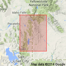
Named for Smiths Fork guard station in NW1/4 NE1/4 sec 27, T29N, R11W, Lincoln Co, WY in the Greater Green River basin. Two reference sections designated nearby: 1) in sec 24, T29N, R118W, and 2) sec 33, T29N, R118W. The lower unnamed member, which consists of black ferruginous shale, is easily distinguished from the gray limestone and calcareous red, purplish, and gray siltstone beds of the underlying Gannett Group. The upper unnamed member, which consists of tan, very fine grained quartzitic sandstone, is easily distinguished from the variegated mudstone and sandstone and nodular limestone of the overlying Thomas Fork Formation (a new name). Is 700 ft thick at its type section; 755+ ft thick at reference section 1; 311+ ft thick at reference section 2. Fossil Unios and gastropods give an Early Cretaceous (Kootenai-Cloverly) age. Is part of the western sequence and thought to be equivalent to lower part of Bear River Formation to the east. The upper unnamed sandstone was formerly assigned to Tygee Sandstone (abandoned in this report).
Source: GNU records (USGS DDS-6; Denver GNULEX).
For more information, please contact Nancy Stamm, Geologic Names Committee Secretary.
Asterisk (*) indicates published by U.S. Geological Survey authors.
"No current usage" (†) implies that a name has been abandoned or has fallen into disuse. Former usage and, if known, replacement name given in parentheses ( ).
Slash (/) indicates name conflicts with nomenclatural guidelines (CSN, 1933; ACSN, 1961, 1970; NACSN, 1983, 2005, 2021). May be explained within brackets ([ ]).

