- Usage in publication:
-
- Sligo Formation
- Modifications:
-
- Overview
- AAPG geologic province:
-
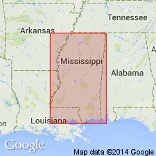
- Mid-Gulf Coast basin
Summary:
Sligo Formation penetrated completely in four wells and partially penetrated in six others. Unit is approximately 465 ft thick in Raymond Field and consists of interbedded sands, siltstone, shales, and mudstones. Interval is nonproductive. Age is Early Cretaceous (Coahuilan).
Source: GNU records (USGS DDS-6; Reston GNULEX).
For more information, please contact Nancy Stamm, Geologic Names Committee Secretary.
Asterisk (*) indicates published by U.S. Geological Survey authors.
"No current usage" (†) implies that a name has been abandoned or has fallen into disuse. Former usage and, if known, replacement name given in parentheses ( ).
Slash (/) indicates name conflicts with nomenclatural guidelines (CSN, 1933; ACSN, 1961, 1970; NACSN, 1983, 2005, 2021). May be explained within brackets ([ ]).

