The National Geologic Map Database is migrating to a new infrastructure. We apologize for any service disruptions during this process.
|
|---|


- Usage in publication:
-
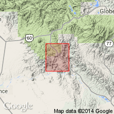
- Sleeping Buffalo Rhyolite*
- Modifications:
-
- Named
- Dominant lithology:
-
- Rhyolite
- AAPG geologic province:
-
- Basin-and-Range province
Summary:
Named for exposures on and near The Sleeping Buffalo, a hill in secs 3 and 4, T3S, R12E, its type locality, Pinal Co, AZ in the Basin-and-Range province. Divided into two mapped members--a gray to buff flow-banded rhyolite mapped in northwest corner of quad named Arnett Member, and the laterally equivalent unnamed tuff member 0-120 m thick mapped on west side of quad. Measured section of tuff member. Occurs as pink, red, white, and tan rhyolite flows, intrusive rocks, and breccias in several large and several small outcrops at the west side of the map. One mass grades from intrusive to flow and includes agglomerates, glass borders, autobreccia, distorted flow layering and gas-rich phases that produced pumice. Flows are locally glassy, perlitic, devitrified, and microcrystalline. Rhyolite is porphyritic and glomeroporphyritic. Phenocrysts consist of plagioclase, quartz, sanidine, biotite, and magnetite in a glassy, devitrified, or aphanitic microcrystalline groundmass. Plagioclase (oligoclase) is euhedral to subhedral, 1-3 mm maximum dimension, 5-15 percent of rock. Quartz ranges from euhedral to anhedral, rounded to resorbed, 2-3 mm diameter, 15-25 percent of rock. Sanidine is anhedral to subhedral, 2-3 mm maximum dimension, 15-20 percent of rock. K-Ar age on biotite in plug of 17.5 +/-0.7 m.y., and of 18, 16.6, and 15.9 m.y. rhyolite in quad to west. Of Miocene age.
Source: GNU records (USGS DDS-6; Denver GNULEX).
For more information, please contact Nancy Stamm, Geologic Names Committee Secretary.
Asterisk (*) indicates published by U.S. Geological Survey authors.
"No current usage" (†) implies that a name has been abandoned or has fallen into disuse. Former usage and, if known, replacement name given in parentheses ( ).
Slash (/) indicates name conflicts with nomenclatural guidelines (CSN, 1933; ACSN, 1961, 1970; NACSN, 1983, 2005, 2021). May be explained within brackets ([ ]).