

- Usage in publication:
-
- Skyline Trail Conglomerate Member
- Modifications:
-
- Named
- Dominant lithology:
-
- Conglomerate
- AAPG geologic province:
-
- Yellowstone province
Summary:
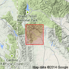
Assigned to Hoback Formation. No type locality designated. Named for exposures along Skyline Trail which is in a high, narrow valley between Hoback and Gros Ventre Ranges extending from west side of Granite Creek northwest into headwater of North Fork of Horse Creek, T39N, R114W, Teton Co, WY in the Yellowstone province. Mapped (geologic map) in several bodies south of the Trail. Conformably overlies part of the Hoback. Crops out beneath patches of Pleistocene moraine. Consists almost entirely of coarse clasts of a wide variety of Paleozoic and Mesozoic sedimentary rocks--especially from Cretaceous, Triassic, Jurassic, moderately well-cemented in sparse red clay and silt matrix. Thin lenses of red clay and silt occur at intervals through the section. Clast sizes range from pebbles to large subangular and angular blocks more than 1 m in diameter. No Precambrian igneous clasts. Distinguishable from other conglomerates in Hoback by large average size, particularly of soft, weak Cretaceous sandstone and Triassic siltstone, by its red color, by its matrix, by its fine clastic strata. Interpreted to be a coalescing alluvial fan deposit. Has been mapped as part of Camp Davis and of Pass Peak Formations. Mollusks indicate late Paleocene age.
Source: GNU records (USGS DDS-6; Denver GNULEX).
For more information, please contact Nancy Stamm, Geologic Names Committee Secretary.
Asterisk (*) indicates published by U.S. Geological Survey authors.
"No current usage" (†) implies that a name has been abandoned or has fallen into disuse. Former usage and, if known, replacement name given in parentheses ( ).
Slash (/) indicates name conflicts with nomenclatural guidelines (CSN, 1933; ACSN, 1961, 1970; NACSN, 1983, 2005, 2021). May be explained within brackets ([ ]).