- Usage in publication:
-
- Skull Ridge Member
- Modifications:
-
- Named
- Dominant lithology:
-
- Sandstone
- Sand
- Silt
- Conglomerate
- Ash
- AAPG geologic province:
-
- Estancia basin
- San Juan basin
Summary:
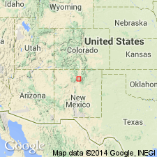
Named as second from base of five members of Tesuque Formation (revised) of Santa Fe Group (ascending): Nambe, Skull Ridge, Pojoaque, Chama-El Rito, and Ojo Caliente Sandstone. Type area of Santa Fe Group is here restricted to north of Santa Fe, in the Rio Grande Valley (includes parts of northern Santa Fe Co (Estancia basin), southeastern Rio Arriba Co (San Juan basin), and southern Taos Co (San Luis basin). In this area, Santa Fe Group is divided into Chamita Formation (top) and Tesuque Formation, with its 5 members (base). Skull Ridge consists of soft sandstones composed of interstratified beds of sand, silt, conglomerate, intraformational conglomerate and numerous volcanic ash beds--the number and variety of the ash beds are a distinctive feature, and they are studied intensively as key marker beds. Type section is a composite of two measured sections: 1) lower part--on a fault block south of Arroyo Seco in N 1/2 of sec 21, T20N, R9E, Santa Fe Co, NM; and 2) upper part--between Arroyo Seco and White Operation Wash, paralleling boundary between secs 8 and 17, T20N, R9E, Santa Fe Co, NM in Estancia basin. Mapped from north of Chimayo in Rio Arriba Co, San Juan basin southward, just east of Pojoaque, to south of Camel Rock. Disconformably underlies Pojoaque Member. Age given as late Hemingfordian to late Barstovian. Geologic map. Sections.
Source: GNU records (USGS DDS-6; Denver GNULEX).
For more information, please contact Nancy Stamm, Geologic Names Committee Secretary.
Asterisk (*) indicates published by U.S. Geological Survey authors.
"No current usage" (†) implies that a name has been abandoned or has fallen into disuse. Former usage and, if known, replacement name given in parentheses ( ).
Slash (/) indicates name conflicts with nomenclatural guidelines (CSN, 1933; ACSN, 1961, 1970; NACSN, 1983, 2005, 2021). May be explained within brackets ([ ]).

