- Usage in publication:
-
- Sixmile Canyon andesite, unit of Sixmile Canyon†
- Modifications:
-
- Abandoned
Summary:
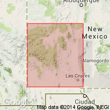
Two units, Sixmile Canyon andesite, and unit of Sixmile Canyon--type locality Sixmile Canyon in eastern Magdalena Mountains, approximately 11 mi southeast of Magdalena, sec 4, T4S, R3W, unsurveyed, South Baldy 7 1/2 min quad, Socorro Co, NM in Orogrande basin--abandoned in this report in favor of Sawmill Canyon Formation (new) to include all post-collapse cauldron-fill units of the Sawmill Canyon cauldron. Abandoned because name has been preempted by prior use elsewhere, and because there are better exposures and a more representative cross section of the cauldron-fill stratigraphy in the Sawmill Canyon cauldron. These rocks shown as Oligocene based on stratigraphic position. ["Sixmile Canyon andesite" was first used by Krewedl, 1974, NM Bureau of Mines Open-File 44; name changed by Chapin, 1978, in NM Bureau of Mines Open-File 113 to "unit of Sixmile Canyon"--neither of these reports are on the computer.] Stratigraphic chart.
Source: GNU records (USGS DDS-6; Denver GNULEX).
For more information, please contact Nancy Stamm, Geologic Names Committee Secretary.
Asterisk (*) indicates published by U.S. Geological Survey authors.
"No current usage" (†) implies that a name has been abandoned or has fallen into disuse. Former usage and, if known, replacement name given in parentheses ( ).
Slash (/) indicates name conflicts with nomenclatural guidelines (CSN, 1933; ACSN, 1961, 1970; NACSN, 1983, 2005, 2021). May be explained within brackets ([ ]).

