

- Usage in publication:
-
- Silver Shield Quartz Latite*
- Modifications:
-
- Named
- Geochronologic dating
- Dominant lithology:
-
- Quartz latite
- AAPG geologic province:
-
- Wasatch uplift
Summary:
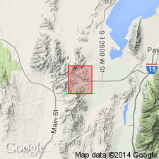
Named from exposures vicinity Silver Shield (Independence) shaft, northeastern part Eureka quad. Type locality SE1/4 sec 35, T9S, R2W and adjacent parts secs 1 and 2, T10S, R2W, Utah Co, UT, Wasatch uplift. Previously, name used informally to refer to dike, but here applied to both wide dike 1 1/2 mi long and associated quartz latite flow unit. Dike crops out boldly, locally 50-75 ft above general elevation of Packard Quartz Latite, which it intrudes. Characterized by well-defined planar structure that strikes parallel to its walls and dips 70-80 degrees south. Where dike merges with flow unit, dip flattens to 20 degrees or less; strike changes to west. Dike cuts Packard and underlying rock, and Pinyon Creek Conglomerate (new), which underlies flow in most areas of exposure. Remnants of flow unit preserved as 5 flatiron-like exposures along east edge of district. Four directly overlie Pinyon Creek Conglomerate; fifth rests on Packard and tuffs of Latite Ridge Latite (new). Origin was eruptive lava flow, not a sill. Quartz latite of dike and flow is medium to dark gray and coarsely porphyritic. Large phenocrysts make up 25-30 percent of rock. Plagioclase phenocrysts tend to clump, producing irregular rosettes. Though few in number, potassium feldspar crystals form largest phenocrysts. Large rounded and fractured grains of clear quartz also present. Dike and flow dated by K-Ar as middle Miocene. Geologic map, measured sections.
Source: GNU records (USGS DDS-6; Denver GNULEX).
For more information, please contact Nancy Stamm, Geologic Names Committee Secretary.
Asterisk (*) indicates published by U.S. Geological Survey authors.
"No current usage" (†) implies that a name has been abandoned or has fallen into disuse. Former usage and, if known, replacement name given in parentheses ( ).
Slash (/) indicates name conflicts with nomenclatural guidelines (CSN, 1933; ACSN, 1961, 1970; NACSN, 1983, 2005, 2021). May be explained within brackets ([ ]).