- Usage in publication:
-
- Silver Lake Metavolcanics*
- Modifications:
-
- Named
- Dominant lithology:
-
- Metavolcanics
- Schist
- Quartzite
- Conglomerate
- Tuff
- AAPG geologic province:
-
- Northern Rocky Mountain region
Summary:
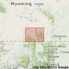
Named as middle formation of Phantom Lake Metamorphic Suite in the Sierra Madre for Silver Lake. Type locality designated as exposures in cliffs between South Spring Creek Lake and Silver Lake, secs 10-13, T14N, R86W, Carbon Co, WY, Northern Rocky Mountain region. Consists of: 1) mafic metavolcanic rocks; 2) paraconglomerate of metasedimentary, granitic, and metavolcanic clasts (as large as boulder size) in matrix of quartz, plagioclase, muscovite, chlorite, biotite, epidote, and amphibole; 3) metagraywacke; 4) metatuff; 5) quartzite; and 6) metacarbonate. The pelitic rocks are not as feldspathic as most of the Silver Lake rocks. Most of the metasedimentary rocks are poorly sorted; some have bimodal grain size distribution. Ranges from 300 to 1000 m in study area. Overlies Jack Creek Quartzite (named) of Phantom Lake. Underlies Bridger Creek Quartzite (named) of Phantom Lake. Deposited in an environment of scattered subaerial mafic volcanic centers that shed lava flows and tuffaceous rocks in surrounding basins. Rapid facies changes and poor sorting suggest rapid deposition perhaps as alluvial fans, fan deltas, mud flows or turbidity currents. Variety of clasts in paraconglomerates suggest attendant uplift. Stratigraphic charts. Petrographic data. Geologic map. Of Late Archean age. Intruded by felsic igneous rocks thought to be equivalent to the 2,700 Ma Spring Lake Granodiorite.
Source: GNU records (USGS DDS-6; Denver GNULEX).
For more information, please contact Nancy Stamm, Geologic Names Committee Secretary.
Asterisk (*) indicates published by U.S. Geological Survey authors.
"No current usage" (†) implies that a name has been abandoned or has fallen into disuse. Former usage and, if known, replacement name given in parentheses ( ).
Slash (/) indicates name conflicts with nomenclatural guidelines (CSN, 1933; ACSN, 1961, 1970; NACSN, 1983, 2005, 2021). May be explained within brackets ([ ]).

