The National Geologic Map Database is migrating to a new infrastructure. We apologize for any service disruptions during this process.
|
|---|


- Usage in publication:
-
- Silver Hill formation*
- Modifications:
-
- Named
- Dominant lithology:
-
- Limestone
- Shale
- AAPG geologic province:
-
- Montana folded belt
Summary:
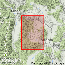
Named for hill south of Silver Lake in Deer Lodge Co, MT in Montana folded belt province. Type section designated on east face of Silver Hill. [Measured section is a composite with only lower and middle parts from type area.] Additional outcrops occur in drainage basins of East Fork of Rock Creek and Lost Creek, Franklin Hill, Maywood Ridge, south end of Flint Creek Range, and Anaconda Range. Generally poorly exposed as is susceptible to erosion. Usually occupies topographic depressions. Divided into three parts. Lower part consists of olive-green, calcareous shale with distinctive whitish lenses a few millimeters thick and a few centimeters broad. Middle part is white or gray limestone with thin laminae of gray or brown siliceous material resembling chert which stands out in relief on weathered surfaces. Upper part is brown, white, and green bonded calcareous shale interbedded with laminated limestone. Average thickness is 400 ft. At type section is about 330 ft thick. Contacts with underlying Cambrian Flathead quartzite and overlying Cambrian Hasmark formation (new) are gradational. Geologic map. Measured composite section. Columnar section. Tentatively correlates with Park shale, Meagher limestone, and Wolsey shale in the Little Belt Mountains. Cambrian age based on stratigraphic position.
Source: GNU records (USGS DDS-6; Denver GNULEX).
- Usage in publication:
-
- Silver Hill formation
- Modifications:
-
- Age modified
- AAPG geologic province:
-
- Montana folded belt
Summary:
Middle Cambrian age substantiated by fossil evidence from two localities, one in vicinity of Princeton and other near head of Rock Creek southwest of Philipsburg, both in Granite Co, MT, Montana folded belt province. Fossil evidence not discussed.
Source: GNU records (USGS DDS-6; Denver GNULEX).
- Usage in publication:
-
- Silver Hill formation
- Modifications:
-
- Age modified
- AAPG geologic province:
-
- Montana folded belt
Summary:
Correlates three [informal] members of Silver Hill formation in Philipsburg area, Granite County, Montana, Montana folded belt province, with Middle Cambrian Wolsey, Meagher, and Park formations of southern Montana. A Meagher fauna is present in middle limestone member of Silver Hill. Top of Silver Hill marks top of Middle Cambrian. Underlies Hasmark formation.
Source: GNU records (USGS DDS-6; Denver GNULEX).

- Usage in publication:
-
- Silver Hill formation
- Modifications:
-
- Areal extent
- AAPG geologic province:
-
- Montana folded belt
Summary:
Restricted to Philipsburg area, Granite Co, MT, Montana folded belt province. Correlates with Wolsey shale which is recognized throughout central and southwest MT. In Philipsburg area, Silver Hill differs from typical Wolsey in that Silver Hill contains a 100 ft thick middle limestone member. Here Silver Hill ranges from 250-350 ft thick. Correlation with Wolsey established by presence of GLOSSOPLEURA in middle limestone member. Correlates with Gordon shale and Damnation and Dearborn limestones in northwest MT. Overlies Flathead sandstone; underlies Hasmark formation. Correlation chart. Cross sections. Isopach map of combined Wolsey and Silver Hill. Measured section. Middle Cambrian age.
Source: GNU records (USGS DDS-6; Denver GNULEX).
- Usage in publication:
-
- Silver Hill Formation
- Modifications:
-
- Areal extent
- AAPG geologic province:
-
- Montana folded belt
Summary:
Extends unit into northwest part of Garnet Range in west-central MT, Montana folded belt province. Unit typified by middle member of laminated limestone separating two green shale units. Best exposed along Secret Gulch, northern Garnet Co. Thickness appears to decrease from east to west in mapped area; 400 ft along Rattler Gulch, 345 ft along Secret Gulch; 150 ft along Marcella Gulch; and missing entirely along Ryan Creek [Gulch on map]. Gradational contact with underlying Flathead Formation [also referred to as Flathead Quartzite]; locally where Flathead is missing, unconformably lies on Precambrian quartzite. Underlies Hasmark Formation. Stratigraphic chart. Geologic map. Cross sections. Measured section. Middle Cambrian (Albertan) age based on trilobite ALBERTELLA.
Source: GNU records (USGS DDS-6; Denver GNULEX).

- Usage in publication:
-
- Silver Hill limestone [member]
- Modifications:
-
- Revised
- AAPG geologic province:
-
- Montana folded belt
Summary:
Referred to informally as middle member of Wolsey Formation. Also called middle limestone of Wolsey in this report. Unit consists of a very prominent, thinly bedded, silty sparite. Ranges in thickness from 2-30 m. Study area is west of Three Forks within parts of Madison, Jefferson and Gallatin Cos, MT, Montana folded belt province. Middle Cambrian age.
Source: GNU records (USGS DDS-6; Denver GNULEX).
- Usage in publication:
-
- Silver Hill Formation*
- Modifications:
-
- Areal extent
- AAPG geologic province:
-
- Montana folded belt
Summary:
Outcrops in southern part of quad between Alberton and Kitchen Creek, east of Ellis Mountain, mouth of Rock Creek, and along Clark Fork in Mineral and Missoula Cos, MT in Montana folded belt province. Consists of lower shale member about 135 ft thick and upper limestone member about 425 ft thick. Trilobites including GLOSSOPLEURA and ALBERTELLA, VANUXEMELLA, and CAMBROTRYPA found in upper part of shale member. GLOSSOPLEURA is also present in Damnation Limestone and ALBERTELLA is also present in Gordon Shale in northwestern MT. Conformably overlies Middle Cambrian Flathead Quartzite; conformably underlies Middle and Upper Cambrian Hasmark Dolomite. Cross section. Geologic map.
Source: GNU records (USGS DDS-6; Denver GNULEX).
- Usage in publication:
-
- Silver Hill Formation*
- Modifications:
-
- Areal extent
- AAPG geologic province:
-
- Montana folded belt
Summary:
Assigned to unnamed rocks mapped as Cambrian? by Nelson and Dobell (1961, U.S. Geological Survey Bulletin 1111-F, p. 189-235). Consists of 120 sq mi study area north of Missoula, MT, Montana folded belt province. Outcrops strike northwest and occur in southeast and west-central part of map area. Consists of a 200 ft thick interbedded shale, siltstone and sandstone in lower part and a 300-400 ft thick limestone in upper part. Unconformably overlies Late Proterozoic? diabase sills and dikes; in unconformable contact with Middle Proterozoic Pilcher Quartzite. Unconformably underlies Quaternary deposits. Fossils and animal tracks and burrows found in several beds in shale and limestone. Dutro, Zen and Taylor (1975, abstract, Geological Society of America) reported fossils of Middle Cambrian fauna from GLOSSOPLEURA Zone within lower shale near Blue Point at head of Johnson Gulch in south part of study area.
Source: GNU records (USGS DDS-6; Denver GNULEX).
- Usage in publication:
-
- Silver Hill Formation
- Modifications:
-
- Areal extent
- AAPG geologic province:
-
- Montana folded belt
Summary:
Authors propose extending Middle and Upper Cambrian units of Wells (1974) in Alberton area, Mineral Co, MT northwest to Libby area, Lincoln Co, MT, a distance of 76 mi. Within study area, located in Montana folded belt province, Silver Hill overlies Flathead Formation with gradational contact and underlies Hasmark Dolomite. Authors divide unit into a lower shale member and an upper limestone member. Limestone member is part of Aadland's (1979, unpublished thesis) facies number one of Fishtrap Dolomite. Total thickness of Cambrian units is 3248 ft in Libby area and 2380 ft in Alberton area; difference in thickness due to erosion at top of Red Lion in Alberton area. Middle Cambrian trilobites and rare brachiopods found in lower shale member.
Source: GNU records (USGS DDS-6; Denver GNULEX).
- Usage in publication:
-
- Silver Hill Formation*
- Modifications:
-
- Revised
- AAPG geologic province:
-
- Montana folded belt
Summary:
Overlies the Black Lion Conglomerate (new) in report area, Montana folded belt province. Is of Middle Cambrian age.
Source: GNU records (USGS DDS-6; Denver GNULEX).
For more information, please contact Nancy Stamm, Geologic Names Committee Secretary.
Asterisk (*) indicates published by U.S. Geological Survey authors.
"No current usage" (†) implies that a name has been abandoned or has fallen into disuse. Former usage and, if known, replacement name given in parentheses ( ).
Slash (/) indicates name conflicts with nomenclatural guidelines (CSN, 1933; ACSN, 1961, 1970; NACSN, 1983, 2005, 2021). May be explained within brackets ([ ]).