

- Usage in publication:
-
- Sil Murk formation*
- Modifications:
-
- Named
- Dominant lithology:
-
- Conglomerate
- Fanglomerate
- Sandstone
- Basalt
- Tuff
- AAPG geologic province:
-
- Basin-and-Range province
Summary:
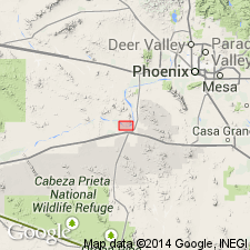
Name applied to extensive exposures of conglomerate, fanglomerate, sandstone, basalt and tuff 2 to 4 mi northwest of the village of Sil Murk, Maricopa Co, AZ, Basin-and-Range province. Sandstone and conglomerate underlie valleys or form slopes. Volcanics form cuestas and low hills. Base and top not exposed in area. Two members mapped. Sedimentary member at least 1,500 ft thick at base has a lower sandstone facies (about 100 ft exposed) composed of medium- to coarse-grained, arkosic brick-red sandstone and an overlying gray conglomerate facies of poorly sorted boulder to pebble conglomerate, sandstone, and mudstone. Sandstone facies is weakly cemented with lime; the beds range from an inch to about 12 inches thick, pebbly to cobbly beds increase in proportion upwards. Conglomerate facies has a decrease in size of fragments from east to west, the pebbly sandstone and mudstone are thin-bedded; sandstones are cross-bedded. Larger fragments in the conglomerate are gneissic granite, schist, quartzite, granite. The volcanic member at top (two measured sections: 175+/-ft, 115+/-ft thick) has eolian tuffaceous sandstone, dacitic tuff, welded tuff, basalt flows and intercalated conglomerate lenses. May correlate with Locomotive fanglomerate. Assigned a Tertiary age. Cross section.
Source: GNU records (USGS DDS-6; Denver GNULEX).
- Usage in publication:
-
- Sil Murk Formation
- Modifications:
-
- Geochronologic dating
- AAPG geologic province:
-
- Basin-and-Range province
Summary:
A welded tuff in the upper part of the Sil Murk yielded a whole rock, K-Ar age of 27 +/-3.8 m.y. from a sample collected north of Gila, Maricopa Co, AZ in the Basin-and-Range province.
Source: GNU records (USGS DDS-6; Denver GNULEX).
For more information, please contact Nancy Stamm, Geologic Names Committee Secretary.
Asterisk (*) indicates published by U.S. Geological Survey authors.
"No current usage" (†) implies that a name has been abandoned or has fallen into disuse. Former usage and, if known, replacement name given in parentheses ( ).
Slash (/) indicates name conflicts with nomenclatural guidelines (CSN, 1933; ACSN, 1961, 1970; NACSN, 1983, 2005, 2021). May be explained within brackets ([ ]).