- Usage in publication:
-
- Signal Granite*
- Modifications:
-
- Named
- Dominant lithology:
-
- Granite
- AAPG geologic province:
-
- Southwestern Basin-and-Range region
Summary:
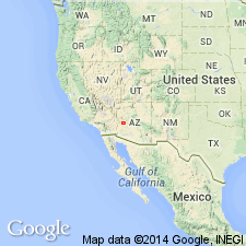
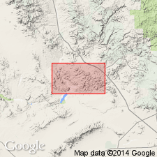
Named for town of Signal, Mohave Co, AZ in the Southwestern Basin-and-Range region. Type locality established in sec 9, T13N, R13W and sec 7, T12N, R13W, between town of Signal and Eagle Point in the Artillery Peak quad. Is a light-gray to medium-brown-gray, medium- to coarse-grained biotite granite or monzogranite pluton. Is cut by quartz, pegmatite and aplite veins, and diabase, porphyry and leucogranite dikes. The pluton is about 30 km in diameter and is best exposed in north part of Artillery Mountains. Northern contact is intrusive; eastern contact unknown (no mapping); western contact poorly exposed and structurally complex. Occurs along 113 degrees 50 min west in Casteneda Hills quad. Southern extent granite is sheared, altered, and mylonitized. Assigned to the Precambrian. Generalized areal extent map.
Source: GNU records (USGS DDS-6; Denver GNULEX).

- Usage in publication:
-
- Signal Granite*
- Modifications:
-
- Age modified
- Geochronologic dating
- AAPG geologic province:
-
- Basin-and-Range province
Summary:
Age is Middle Proterozoic based on U/Pb ages of 1409.6 +/-2.5 Ma and 1410 +/-3 Ma (J.L. Wooden, written commun., 1988) on samples from unit.
Source: GNU records (USGS DDS-6; Menlo GNULEX).

- Usage in publication:
-
- Signal Granite*
- Modifications:
-
- Geochronologic dating
- AAPG geologic province:
-
- Southwestern Basin-and-Range region
Summary:
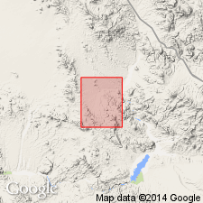
Isotopic ratios of U-Pb on zircons from two samples yielded an age of 1409.6 +/-2.5 Ma (Middle Proterozoic) (date provided by J. L. Wooden, USGS, 1987). Unit outcrops in western half of map, Mohave Co, AZ, Southwestern Basin-and-Range region.
Source: GNU records (USGS DDS-6; Denver GNULEX).

- Usage in publication:
-
- Signal Granite*
- Modifications:
-
- Overview
- AAPG geologic province:
-
- Southwestern Basin-and-Range region
Summary:
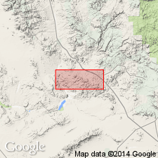
Mapped as a large body from Eagle Point north to Rupley Wash on the east side of the quad, Mohave Co, AZ, in the Southwestern Basin-and-Range region. Described in this report as a light- to medium-brownish-gray leucocratic to mesocratic, unfoliated to weakly foliated, typically massive, locally jointed and spheroidally-weathered, medium- to coarse-grained, porphyritic, biotite granite or monzogranite. Local zones of closely spaced subparallel joints in areas of crustal disturbance. Leucocratic and mesocratic phases form coherent bodies measuring hundreds of meters. Cut by numerous shear zones. Phenocrysts of twinned potassium feldspar usually 2-3 cm long. Has a coarse-grained equigranular phase locally. A gneiss, mapped as older than the Signal, may include a marginal facies of the Signal. Precambrian age.
Source: GNU records (USGS DDS-6; Denver GNULEX).
For more information, please contact Nancy Stamm, Geologic Names Committee Secretary.
Asterisk (*) indicates published by U.S. Geological Survey authors.
"No current usage" (†) implies that a name has been abandoned or has fallen into disuse. Former usage and, if known, replacement name given in parentheses ( ).
Slash (/) indicates name conflicts with nomenclatural guidelines (CSN, 1933; ACSN, 1961, 1970; NACSN, 1983, 2005, 2021). May be explained within brackets ([ ]).

