The National Geologic Map Database is migrating to a new infrastructure. We apologize for any service disruptions during this process.
|
|---|


- Usage in publication:
-
- Shwin Formation*
- Modifications:
-
- Named
- Biostratigraphic dating
- Mapped
- Dominant lithology:
-
- Argillite
- Metadolerite
- Greenstone
- Phyllite
- Slate
- Limestone
- Mudstone
- AAPG geologic province:
-
- Great Basin province
Summary:
Pg. 9 (table 1), 11-14, pl. 1 (geol. map), pl. 3 (corr. chart), pl. 4 (fossil locs.). Shwin Formation. Formal proposal of name. Present in lower plate of Roberts thrust (carbonate eastern facies). Principally chloritic argillite, metadolerite, greenstone, chloritic phyllite, black limy slate, mottled shaly limestone, limy mudstone, and calc-phyllite. Locally formation is complexly even isoclinally folded, beds are commonly sheared out, and interlayering of metavolcanics and limy mudstone may indeed be wholly mechanical rather than depositional. Estimated thickness 1,500 to 2,000 feet. All contacts of formation with others are faults (with possible exception of one north of Hancock Canyon with dolomite correlated with El Dorado Dolomite, and even this is sheared). Age is considered Middle Cambrian, based on fossils (trilobites, brachiopods). Report includes geologic map, faunal list, correlation chart.
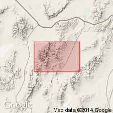
Well exposed on and east of Shwin Ranch, from which formation is named, on south slope of the ridge between Goat Canyon and the North Fork of Mill Creek, northern Shoshone Range, Mount Lewis 15-min quadrangle, Lander Co., northern NV.
Source: Publication; US geologic names lexicon (USGS Bull. 1350, p. 692).
For more information, please contact Nancy Stamm, Geologic Names Committee Secretary.
Asterisk (*) indicates published by U.S. Geological Survey authors.
"No current usage" (†) implies that a name has been abandoned or has fallen into disuse. Former usage and, if known, replacement name given in parentheses ( ).
Slash (/) indicates name conflicts with nomenclatural guidelines (CSN, 1933; ACSN, 1961, 1970; NACSN, 1983, 2005, 2021). May be explained within brackets ([ ]).