

- Usage in publication:
-
- Shubuta member
- Modifications:
-
- Original reference
- Dominant lithology:
-
- Clay
- AAPG geologic province:
-
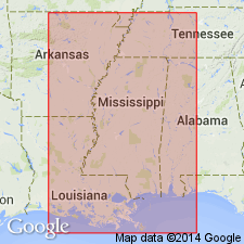
- Mid-Gulf Coast basin
Summary:
Pg. 1838 (fig. 6), 1839 (footnote). Shubuta (clay) member of Yazoo clay (or formation) proposed for 20 to 250 feet of clays and clayey marls, underlain by the Pachuta (marl) member (new) and overlain by the Forest Hill or Red Bluff clay of the Oligocene. Recognized in eastern Mississippi and western Alabama. Age is late Eocene.
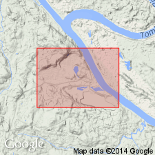
Type locality: east side of Chickasawhay River, just north of U.S. Highway 45 bridge east of Shubuta, in SW/4 sec. 3, T. 10 N., R. 16 E., Clarke Co., eastern MS.
Source: US geologic names lexicon (USGS Bull. 1200, p. 3591).
- Usage in publication:
-
- Shubuta member*
- Modifications:
-
- Areal extent
- AAPG geologic province:
-
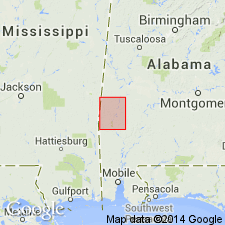
- Mid-Gulf Coast basin
Summary:
Pg. 122, 126, pl. 3. Shubuta member of Yazoo clay. In Choctaw County, western Alabama, consists of light-greenish-gray and white highly calcareous clay which weathers to light greenish yellow to white; contains small irregular white lime concretions; in many places it is a white chalky calcareous clay or clayey limestone. Thickness 25 to 35 feet. [Age is late Eocene.]
Source: US geologic names lexicon (USGS Bull. 1200, p. 3591).
- Usage in publication:
-
- [Shubuta member]
- Modifications:
-
- Areal extent
- AAPG geologic province:
-
- Arkla basin
Summary:
Pg. 702 (fig. 1), 703. [Shubuta member of Yazoo clay of the Jackson group.] Underlies Mosley Hill formation. [Age is late Eocene.]
Source: US geologic names lexicon (USGS Bull. 1200, p. 3591).
- Usage in publication:
-
- Shubuta Member
- Modifications:
-
- Age modified
- Biostratigraphic dating
- AAPG geologic province:
-
- Mid-Gulf Coast basin
Summary:
Age of Shubuta Member of Yazoo Clay is Eocene and Oligocene.
Source: GNU records (USGS DDS-6; Reston GNULEX).
- Usage in publication:
-
- Shubuta Member
- Modifications:
-
- Age modified
- AAPG geologic province:
-
- Mid-Gulf Coast basin
Summary:
Eocene-Oligocene boundary occurs at the top of this unit.
Source: GNU records (USGS DDS-6; Reston GNULEX).
- Usage in publication:
-
- Shubuta Member*
- Modifications:
-
- Age modified
- Biostratigraphic dating
- AAPG geologic province:
-
- Mid-Gulf Coast basin
Summary:
Age of Shubuta Member changed from late Eocene to late Eocene and early Oligocene based on study of planktonic Foraminifera. [This revised age is not widely accepted by other workers in the area.]
Source: GNU records (USGS DDS-6; Reston GNULEX).

- Usage in publication:
-
- Shubuta Member
- Modifications:
-
- Overview
- AAPG geologic province:
-
- Mid-Gulf Coast basin
Summary:
Pg. 78-79. Shubuta Member of Yazoo Clay of the Jackson Group. Light-greenish-gray to white fossiliferous, calcareous clay containing many small irregular white calcareous nodules. Grades eastward from the Tombigbee River into grayish-yellow-green sandy, very glauconitic marl and white limestone of the Crystal River Formation. Overlies Pachuta Marl Member of the Yazoo Clay and unconformably underlies Red Bluff Clay (Oligocene). Thickness ranges from 20 to 36 feet. Present in southwestern Alabama. Age is late Eocene (Priabonian).
See also L.D. Toulmin, 1977, Alabama Geol. Survey Mon., no. 13, p. 126-129.
Source: Publication.
For more information, please contact Nancy Stamm, Geologic Names Committee Secretary.
Asterisk (*) indicates published by U.S. Geological Survey authors.
"No current usage" (†) implies that a name has been abandoned or has fallen into disuse. Former usage and, if known, replacement name given in parentheses ( ).
Slash (/) indicates name conflicts with nomenclatural guidelines (CSN, 1933; ACSN, 1961, 1970; NACSN, 1983, 2005, 2021). May be explained within brackets ([ ]).