

- Usage in publication:
-
- Shublik formation*
- Modifications:
-
- Named
- Biostratigraphic dating
- Dominant lithology:
-
- Limestone
- Shale
- Sandstone
- AAPG geologic province:
-
- Alaska Northern region
Summary:
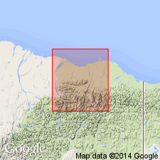
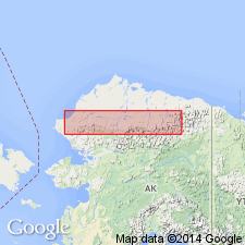
Type locality in Shublik Island on Canning River at southwest corner of Shublik Mountains, northeastern AK. Occurs chiefly in outlying structural valleys. Measured sections of part of unit described at Camp 263 Creek (1350 ft thick) and near east end of Third Range, Sadlerochit River (430 ft thick). Consists of dark limestone, shale, and sandstone. Overlies Pennsylvanian Sadlerochit sandstone and underlies Kingak shale (of early Jurassic age); contacts are probably conformable although not seen. List of fossils identified by T.W. Stanton included in report. Unit shown on geologic map of Canning River region as of Late Triassic age.
Source: GNU records (USGS DDS-6; Menlo GNULEX).
- Usage in publication:
-
- Shublik formation*
- Modifications:
-
- Areal extent
- AAPG geologic province:
-
- Alaska Northern region
Summary:
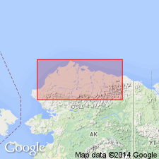
Geographically extended to Southern Foothills as shown on stratigraphic section and geologic map of North Slope, northern AK. List of fossils included.
Source: GNU records (USGS DDS-6; Menlo GNULEX).
- Usage in publication:
-
- Shublik formation*
- Modifications:
-
- Overview
- AAPG geologic province:
-
- Alaska Northern region
Summary:
Composed principally of highly carbonaceous grayish-black shale, chert, and limestone. Comprises three members in Tiglukpuk Creek and upper Kiruktagiak River areas: lower member of black, gray, and greenish-gray shale with minor intercalated dark limestone about 100 ft thick in upper Kiruktagiak River area but more than 500 ft thick in Tiglukpuk Creek area, with fauna of Middle Triassic age; middle member of dark siliceous limestone, black paper shale, and dark carbonaceous shale; and upper member of dark fossiliferous limestone capped by dark shale. Middle and upper members, 130 to 150 ft thick and 60 to 80 ft thick respectively; both have Late Triassic fossil assemblage. Formation mapped and correlated over most of northern AK.
Source: GNU records (USGS DDS-6; Menlo GNULEX).
- Usage in publication:
-
- Shublik formation*
- Modifications:
-
- Age modified
- Biostratigraphic dating
- AAPG geologic province:
-
- Alaska Northern region
Summary:
Age of Shublik Formation changed to: Middle and Late Triassic based on conodont, foraminifers, and ammonite-pelecypod fauna. Collections described from Tiglukpuk Creek, Welcome Creek, Kiruktagiak Creek, and Noluck Lake areas.
Source: GNU records (USGS DDS-6; Menlo GNULEX).
- Usage in publication:
-
- Shublik formation*
- Modifications:
-
- Revised
- AAPG geologic province:
-
- Alaska Northern region
Summary:
Leffingwell's (1919) section at Camp 263 Creek included unit "1" (800-ft unit of unexposed, probably soft shales) and unit "5" (300-ft unit of unexposed, probably soft rocks). Authors believe only Leffingwell's units 2, 3, and 4 constitute total Shublik formation. Unit 5 is considered to be part of Sadlerochit formation. 4 measured sections, list of fossils with locations, and geologic map of Shaviovik and Sagavanirktok Rivers region included in report.
Source: GNU records (USGS DDS-6; Menlo GNULEX).
- Usage in publication:
-
- Shublik formation*
- Modifications:
-
- Age modified
- Biostratigraphic dating
- AAPG geologic province:
-
- Alaska Northern region
Summary:
Shale member of Shublik is assigned to Middle Triassic "but may also be in part of Early Triassic age", p. 435. Chert and limestone members are assigned Late Triassic age on basis of widespread occurrence of ENTOMONOTIS SUBCIRCULARIS Gabb and HALOBIA sp. Measured sections of Shublik on Erratic Creek, Tiglukpuk Creek, Autumn Creek, and Monotis Creek, with collections of fossils, and geologic map of Killik-Itkillik region included in report.
Source: GNU records (USGS DDS-6; Menlo GNULEX).
- Usage in publication:
-
- Shublik Formation*
- Modifications:
-
- Age modified
- AAPG geologic province:
-
- Alaska Northern region
Summary:
Overall age of Shublik Formation is Early, Middle, and Late Triassic. "Shale member" as defined by Patton and Tailleur (1964) in Killik-Itkillik region contains middle Early Triassic fauna collected several mi south of Sagavanirktok Lake.
Source: GNU records (USGS DDS-6; Menlo GNULEX).
- Usage in publication:
-
- Shublik Formation*
- Modifications:
-
- Reference
- AAPG geologic province:
-
- Alaska Northern region
Summary:
Reference section designated 13.4 km (6.3 mi) N 84 deg W of confluence of Fire Creek with Sadlerochit River, 69 deg 31'45"N, 145 deg 12'W, northeastern Ak, where unit conformably overlies Fire Creek Siltstone Member (new) (Ivishak Formation of Sadlerochit Group) and conformably underlies Karen Creek Sandstone (new). Age of Shublik Formation in northeastern AK is Middle (Anisian) and Late Triassic (Norian) based on megafossil assemblages described in report.
Source: GNU records (USGS DDS-6; Menlo GNULEX).
- Usage in publication:
-
- Shublik Formation*
- Modifications:
-
- Areal extent
- Age modified
- AAPG geologic province:
-
- Alaska Northern region
Summary:
Shublik Formation is restricted to subsurface of Arctic Slope and to area of northeastern Brooks Range, its type locality, and Mount Doonerak area of Endicott Mountains. Rocks of Triassic and Jurassic age in DeLong and most of Endicott Mountains now assigned to newly-named unit, Otuk Formation and its Blankenship Member (new). Shublik Formation is confined to autochthonous terrane of northern AK whereas Otuk Formation, where presently recognized, is confined to allochthonous sheets of central and western Brooks Range. Age of Shublik is Middle and Late Triassic.
Source: GNU records (USGS DDS-6; Menlo GNULEX).
For more information, please contact Nancy Stamm, Geologic Names Committee Secretary.
Asterisk (*) indicates published by U.S. Geological Survey authors.
"No current usage" (†) implies that a name has been abandoned or has fallen into disuse. Former usage and, if known, replacement name given in parentheses ( ).
Slash (/) indicates name conflicts with nomenclatural guidelines (CSN, 1933; ACSN, 1961, 1970; NACSN, 1983, 2005, 2021). May be explained within brackets ([ ]).