The National Geologic Map Database is migrating to a new infrastructure. We apologize for any service disruptions during this process.
|
|---|


- Usage in publication:
-
- Short Creek oolite member
- Modifications:
-
- Original reference
- Dominant lithology:
-
- Limestone
Summary:
Short Creek oolite member of Boone formation. Thin but persistent bed of oolitic limestone, 1.5 to 8 feet thick. Generally a single massive homogeneous bed, but in some places divides into 2 beds which may have slightly different characteristics. Lies about 100 feet above Grand Falls chert member and about 100 feet below Carterville formation.
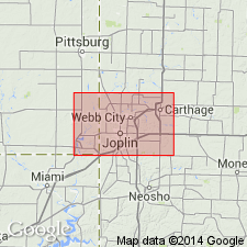
Named (p. 5) from exposures along Short Creek, a stream flowing westward between Galena and Empire in Cherokee Co., KS. The type locality is the north bluff of the creek half a mile south of west of the Empire depot and a hundred yards north of the crossing of the Missouri, Kansas, and Texas and Frisco railways. Thompson (1986, Missouri Dept. Nat. Res., Div. Geol. and Land Survey, Rpt. Inv. 70, pt. 4, p. 95) added "This is just north of the center of the line separating secs. 14 and 15, T. 34 S., R. 25 E. ...Baxter Springs 7.5-min quadrangle."
See also Missouri Geol. Survey lexicon (T.L. Thompson, 2001, Missouri Div. Geol. and Land Survey Rpt. Inv., no. 73, 371 p.).
Source: US geologic names lexicon (USGS Bull. 896, p. 1990); Missouri lexicon (Thompson, 2001, Missouri Geol. Survey Rpt. Inv., no. 73, p. 263-264).
- Usage in publication:
-
- Short Creek Oolite Member*
- Modifications:
-
- Revised
- AAPG geologic province:
-
- Chautauqua platform
- Cherokee basin
Summary:
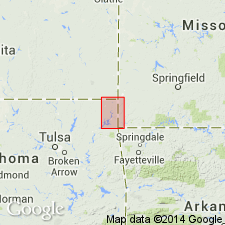
Revised in that Short Creek Oolite Member (1 of 7 members) of Boone Formation disconformably overlies Joplin Member (named) and conformably underlies Baxter Springs Member (named), both of the Boone Formation. Area of study is in the Picher field, a mining district which straddles OK-KS State line just a few miles west of the MO State line on the Chautauqua platform and Cherokee basin. Is a persistent bed of brown, very even textured, oolitic limestone, only slightly glauconitic; is 0-10 ft thick in the mining field. The oolite is even textured, thickly packed, mostly rounded, averaging one fiftieth of an inch in diameter. Is unstable and loses its distinctive texture by recrystallization or solution. Crops out widely along the Neosho River and its tributaries. Isopach map; geologic map; cross section; stratigraphic table. Rare corals, fairly common bryozoans, dominant brachiopods, and a few mollusks, trilobites, and fish remains. Age changed from Mississippian series to Late Mississippian, Meramec.
Source: GNU records (USGS DDS-6; Denver GNULEX).
For more information, please contact Nancy Stamm, Geologic Names Committee Secretary.
Asterisk (*) indicates published by U.S. Geological Survey authors.
"No current usage" (†) implies that a name has been abandoned or has fallen into disuse. Former usage and, if known, replacement name given in parentheses ( ).
Slash (/) indicates name conflicts with nomenclatural guidelines (CSN, 1933; ACSN, 1961, 1970; NACSN, 1983, 2005, 2021). May be explained within brackets ([ ]).