The National Geologic Map Database is migrating to a new infrastructure. We apologize for any service disruptions during this process.
|
|---|


- Usage in publication:
-
- Shoreham member
- Modifications:
-
- Original reference
- Dominant lithology:
-
- Claystone
- Shale
- Limestone
- Metabentonite
- AAPG geologic province:
-
- New England province
Summary:
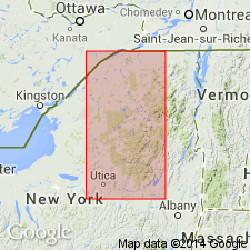
Pg. 264-267. Shoreham member of Sherman Fall formation of Trenton group. Constitutes zone of CRYPTOLITHUS TESSELATUS Green, the limestones of lowest Sherman Fall age. In type region, beds comprise upper Glens Falls limestone, overlie lower Glens Falls Larrabee member of Hull age, and underlie Canajoharie shale of later Sherman Fall age. Beds consistently contain CRYPTOLITHUS TESSELATUS, which is limited to the member, and PRASOPORA ORIENTALIS Ulrich and TREMATIS TERMINALIS (Emmons). This zone persists in the Sherman Fall northwestward to Lennox and Addington County, Ontario, Canada, in the equivalent beds of northern Lake Champlain, and northeastward to city of Quebec. In type section, lower 36 feet of member is exposed. Along Mohawk Valley, member is composed of 15 to 25 feet of dark-gray calcareous claystones and shales that contrast with subjacent Larrabee member, and are succeeded abruptly by Canajoharie shale. Member has exposed thickness of 30 feet north of McBrides Bay, South Hero Township, Grande Isle County, Vermont, with a metabentonite 11 feet from base. Overlying beds are Cumberland Head shaly limestone and Stony Point shale, both of later Sherman Fall age. In New York, underlies Denmark member (new). Age is Middle Ordovician.
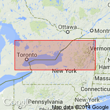
Named from exposures in Shoreham Twp., Addison Co., central western VT.
Source: US geologic names lexicon (USGS Bull. 1200, p. 3587).
- Usage in publication:
-
- Shoreham limestone
- Modifications:
-
- Overview
- AAPG geologic province:
-
- New England province
Summary:
Pg. 1611-1612. Referred to as Shoreham limestone. Overlies Hull formation. Age is Middle Ordovician.
Source: US geologic names lexicon (USGS Bull. 1200, p. 3587).
- Usage in publication:
-
- Shoreham formation
- Modifications:
-
- Revised
- AAPG geologic province:
-
- New England province
Summary:
Pg. 597-606. Shoreham limestone of Trenton group. Rank raised to formation. Disconformably underlies Rathbun limestone member (new) of Denmark formation. Overlies Kirkfield limestone. (Term Kirkfield is preferred to term Hull.) Thickness 45 feet. Age is Middle Ordovician.
Source: US geologic names lexicon (USGS Bull. 1200, p. 3587).
- Usage in publication:
-
- Shoreham member
- Modifications:
-
- Not used
- AAPG geologic province:
-
- New England province
Summary:
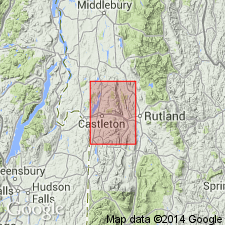
Pg. 31, 34. Blue marble that may be Shoreham member of Glens Falls limestone is called Whipple marble (new) in this report [Castleton area]. It cannot be traced northward around Taconic Range into the Glens Falls outcrop in Sudbury, Vermont.
Source: US geologic names lexicon (USGS Bull. 1200, p. 3587).
- Usage in publication:
-
- Shoreham formation
- Modifications:
-
- Revised
- AAPG geologic province:
-
- New England province
Summary:
Pg. 525-527. Shoreham formation of Trenton group. Extended to include all PRASOPORA ORIENTALIS beds from top of coarse-bedded calcarenites of Kirkfield formation to base of TROCHOLITES subzone and base of Camp member (new) of Denmark formation. Rathbun member of Denmark is herein removed from the Denmark and placed in Shoreham formation. Maximum thickness 52 feet, Lewis County, New York; minimum thickness 15 feet in Mohawk Valley where it spans Adirondack arch. Age is Middle Ordovician.
Source: US geologic names lexicon (USGS Bull. 1200, p. 3587).
- Usage in publication:
-
- Shoreham limestone member
- Modifications:
-
- Revised
- AAPG geologic province:
-
- New England province
Summary:
Pg. 30, 31-32, 81-82, 89-90, pl. 1. Shoreham limestone member, upper member of Glens Falls formation. Thickness about 45 feet on Isle La Motte. Overlies Larrabee limestone member. Underlies Head formation.
Source: US geologic names lexicon (USGS Bull. 1200, p. 3587).
For more information, please contact Nancy Stamm, Geologic Names Committee Secretary.
Asterisk (*) indicates published by U.S. Geological Survey authors.
"No current usage" (†) implies that a name has been abandoned or has fallen into disuse. Former usage and, if known, replacement name given in parentheses ( ).
Slash (/) indicates name conflicts with nomenclatural guidelines (CSN, 1933; ACSN, 1961, 1970; NACSN, 1983, 2005, 2021). May be explained within brackets ([ ]).