


- Usage in publication:
-
- Shoemaker limestone bed
- Modifications:
-
- Original reference
- Dominant lithology:
-
- Limestone
- AAPG geologic province:
-
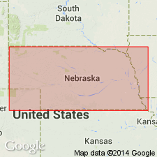
- Forest City basin
Summary:
Pg. 33, 35, 173. Shoemaker limestone bed of Lawrence shale member of Douglas formation. Shoemaker limestone, 8 to 9 feet thick, lies 6 to 7 feet above base of Lawrence shale member and 40 to 43 feet below top of the Lawrence in vicinity of Nehawka, Cass County, southeastern Nebraska. Has been eroded from the Platte exposures. Was erroneously correlated as Oreapolis bed by Condra and Bengston in Nebraska Acad. Sci., v. 9, no. 2, p. 10, 1915. Age is Pennsylvanian.
Named from Shoemaker farm and Shoemaker Bridge, about 3 mi northwest of Nehawka, Cass Co., southeastern NE.
Source: US geologic names lexicons (USGS Bull. 896, p. 1989; USGS Bull. 1200, p. 3585-3586); GNC KS-NE Pennsylvanian Corr. Chart, sheet 1, Oct. 1936.
- Usage in publication:
-
- Shoemaker limestone
- Modifications:
-
- Not used
- AAPG geologic province:
-
- Forest City basin
Summary:
Pg. 11. The so-called Lawrence shale of Bull. 1 is Ladore shale.
[GNC remark (ca. 1938, US geologic names lexicon, USGS Bull. 896, p. 1989): Shoemaker limestone does not appear in subsequent classifications and seems to have been dropped.]
Source: US geologic names lexicon (USGS Bull. 896, p. 1989); GNC KS-NE Pennsylvanian Corr. Chart, sheet 1, Oct. 1936.

- Usage in publication:
-
- Shoemaker limestone member
- Modifications:
-
- Principal reference
- Revised
- AAPG geologic province:
-
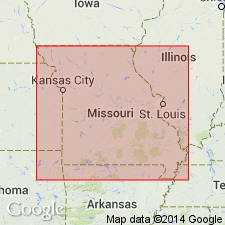
- Forest City basin
Summary:
Pg. 29-30. Shoemaker limestone member of Cass formation. Redefined and reallocated to Cass formation. Shoemaker as here redefined is the lower member of "Shoemaker" limestone defined by Condra (1927); that is, the name is now applied to the lower member of the Cass. Member consists of two dense bluish limestones separated by a shale seam. Thickness about 1.5 feet. Underlies Little Pawnee shale member (new); overlies Plattford formation. Age is Late Pennsylvanian (Virgilian).
Type locality: west of Shoemaker Bridge along-side Shoemaker Farm, about 3 mi northwest of Nehawka, Cass Co., southeastern NE.
Source: US geologic names lexicon (USGS Bull. 1200, p. 3585-3586).
- Usage in publication:
-
- Shoemaker Limestone Member
- Modifications:
-
- Reference
- Areal extent
- AAPG geologic province:
-
- Forest City basin
Summary:
Pg. D526; Appendix D, p. D10. Shoemaker Limestone Member of Cass Formation of Douglas Group. Dark-gray, reddish-brown weathering, fossiliferous limestone. Thickness about 1.5 feet. Overlies Little Pawnee Shale Member of Cass Formation; underlies Pigeon Hill Shale Member of Lawrence Shale. = Condra's (1949) Haskell Limestone Member and upper part of Condra's (1927) Shoemaker Limestone in Nebraska. Age is Late Pennsylvanian (Virgilian).
Reference section: in cutbank on Pigeon Creek at Pigeon Hill Wildlife area, 1,200 ft south of abandoned RR bed, and 800 ft east of bridge on I-29, in SW/4 NW/4 NW/4 sec. 24, T. 56 N., R. 35 W., 3 mi south of intersection of I-29 and I-229, and 8 mi southeast of St. Joseph City Hall, St. Joseph South 7.5-min quadrangle, Buchanan Co., MO. Best exposure is on the north side of the abandoned RR line.
Source: Publication.
For more information, please contact Nancy Stamm, Geologic Names Committee Secretary.
Asterisk (*) indicates published by U.S. Geological Survey authors.
"No current usage" (†) implies that a name has been abandoned or has fallen into disuse. Former usage and, if known, replacement name given in parentheses ( ).
Slash (/) indicates name conflicts with nomenclatural guidelines (CSN, 1933; ACSN, 1961, 1970; NACSN, 1983, 2005, 2021). May be explained within brackets ([ ]).