

- Usage in publication:
-
- Shoal gneiss*
- Modifications:
-
- Named
- Dominant lithology:
-
- Gneiss
- Schist
- AAPG geologic province:
-
- Piedmont-Blue Ridge province
Summary:
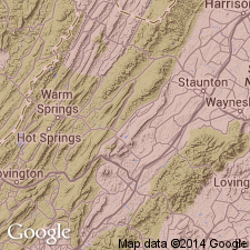
Shoal gneiss named, probably for Shoal Creek, extreme southwestern part of Gossan Lead district, Grayson Co., southwestern VA. Extends from Beaverdam Creek, south of Independence, southwestward to south of New River; lies largely south of US Hwy 58. Consists of fine-grained banded gneiss containing quartz and feldspar porphyroclasts. Also includes sericite schist interlayered with porphyroclastic gneiss. On uplands, schist weathers to micaceous clay soil containing sericitic fragments. In places along Beaverdam and Brush Creeks, near Penitentiary Hill and northward, and in Privett Knob, unit is dark-colored biotite mylonite schist. Predominant rock type between New River and US Hwy 58 and west of Saddle Creek is greenish-gray schist with blue quartz grains and coarse flesh-colored microcline. Includes schist and augen gneiss facies south of Bridle Creek. Age is Precambrian. Mapped as younger than Grayson granodiorite gneiss, younger than associated mylonite. Report includes geologic maps and cross sections.
Source: GNU records (USGS DDS-6; Reston GNULEX).
- Usage in publication:
-
- Shoal gneiss
- Modifications:
-
- Revised
- AAPG geologic province:
-
- Piedmont-Blue Ridge province
Summary:
Shoal gneiss assigned to Virginia Blue Ridge complex.
Source: GNU records (USGS DDS-6; Reston GNULEX).
- Usage in publication:
-
- Shoal Gneiss
- Modifications:
-
- Revised
- AAPG geologic province:
-
- Piedmont-Blue Ridge province
Summary:
Revision by inferred removal from [Virginia] Blue Ridge Complex which is herein abandoned. [Unit not mentioned in report.]
note to me: huh? And, if unit not mentioned in report, where did the GNU staff member get the "Shoals [sic] Gneiss of Elk River Massif is similar to Stage Road Layered Gneiss…" stuff (Saddle Gneiss summary).
Source: GNU records (USGS DDS-6; Reston GNULEX).
For more information, please contact Nancy Stamm, Geologic Names Committee Secretary.
Asterisk (*) indicates published by U.S. Geological Survey authors.
"No current usage" (†) implies that a name has been abandoned or has fallen into disuse. Former usage and, if known, replacement name given in parentheses ( ).
Slash (/) indicates name conflicts with nomenclatural guidelines (CSN, 1933; ACSN, 1961, 1970; NACSN, 1983, 2005, 2021). May be explained within brackets ([ ]).