- Usage in publication:
-
- Shirley Formation
- Modifications:
-
- Named
- Dominant lithology:
-
- Sand
- Silt
- AAPG geologic province:
-
- Atlantic Coast basin
Summary:
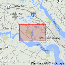
Shirley Formation, herein named in southeastern VA, is an upward-fining sequence composed of a basal, gravelly sand which grades upward into a medium gray to reddish-brown fine to coarse sand, and an upper unit of light to medium gray clayey silt or clayey, silty fine-sand. This formation has been previously mapped as the clayey sand, sand and peat, and gravelly sand facies of the Norfolk Formation. The Norfolk as redefined by Oaks and Coch (1973) has been shown by Peebles and others (1984: VA Minerals, v. 30, no. 2) to consist of two formations, the Tabb and an older unit separated by an unconformity. The Shirley Formation is proposed for the older unit in order to eliminate this stratigraphic problem. Type section is designated at Shirley Plantation in Charles City, where unit is 25.7 ft thick. Thickness ranges from less than 1 ft to 55 ft. Shirley was deposited under fluvial, estuarine, and marsh conditions in the Brandon and Norge area, but also includes barrier, bay, nearshore marine, and eolian deposits on the lower York-James Peninsula, south of the James River. Unit overlies Chuckatuck Formation (new name) and underlies Tabb Formation. Uranium-series ages of 184,000 yrs on corals from correlative deposits place the age of the Shirley at late middle Pleistocene.
Source: GNU records (USGS DDS-6; Reston GNULEX).

- Usage in publication:
-
- Shirley Formation*
- Modifications:
-
- Overview
- Areal extent
- Geochronologic dating
- AAPG geologic province:
-
- Atlantic Coast basin
Summary:
Middle Pleistocene Shirley Formation is mapped in the Coastal Plain region of Virginia along the Potomac, Rappahannock, York, James, Blackwater, and Nottoway Rivers. ASTRANGIA from lower Rappahannock River area has yielded a uranium-series age of 184,000 +/-20,000 yr B.P. (Mixon and others, 1982). Thickness ranges from 0-80 ft.
Source: GNU records (USGS DDS-6; Reston GNULEX).

- Usage in publication:
-
- Shirley Formation
- Modifications:
-
- Overview
- AAPG geologic province:
-
- Atlantic Coast basin
Summary:
Nomenclature on State map follows Johnson and Berquist (1989). Shirley Formation described as light- to dark-gray, bluish-gray and brown sand, gravel, silt, clay, and peat. Constitutes surficial deposits of riverine terraces and relict baymouth barriers and bay-floor plains (altitude 35 to 45 ft) inset below depositional surfaces of the Chuckatuck Formation. Upper part of unit is truncated on the east by the Suffolk and Harpersville scarps. Locally, lower part occurs east and west of scarps. Fluvial-estuarine facies comprises a lower pebble to boulder sand overlain by fine to coarse sand interbedded with peat and clayey silt, rich in organic material including in-situ tree stumps and leaves and seeds of cypress, oak, and hickory, which grades upward to medium- to thick-bedded, clayey and sandy silt and silty clay. Marginal-matrix facies in lower James River and lowermost Rappahannock River area is silty, fine grained sand and sandy silt containing CRASSOSTREA VIRGINICA, MULINIA, NOETIA, MERCENARIA, and other mollusks. ASTRANGIA from lower Rappahannock River area has yielded a uranium-series age of 184,000+/-20,000 yr B.P. according to Mixon and others (1982). Thickness ranges from 0 to 80 ft. Age is middle Pleistocene.
Source: GNU records (USGS DDS-6; Reston GNULEX).
For more information, please contact Nancy Stamm, Geologic Names Committee Secretary.
Asterisk (*) indicates published by U.S. Geological Survey authors.
"No current usage" (†) implies that a name has been abandoned or has fallen into disuse. Former usage and, if known, replacement name given in parentheses ( ).
Slash (/) indicates name conflicts with nomenclatural guidelines (CSN, 1933; ACSN, 1961, 1970; NACSN, 1983, 2005, 2021). May be explained within brackets ([ ]).

