- Usage in publication:
-
- Shipps Creek shale member
- Modifications:
-
- Named
- Dominant lithology:
-
- Shale
- Silt
- Sand
- AAPG geologic province:
-
- Mid-Gulf Coast basin
Thomas, E.P., 1942, The Claiborne: Mississippi Geological Survey Bulletin, no. 48, 96 p.
Summary:
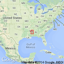
Shipps Creek shale member of Wautubbee formation of Claiborne group named in west-central MS. Consists of carbonaceous shales complexly interbedded and interlensed with silts and sands. Thickness 43 ft at type section. Contact with overlying Cockfield formation varies from sharply defined to transitional. Contact with underlying undifferentiated Wautubbee is conformable and highly transitional, arbitrarily drawn at base of section in which carbonaceous shales are predominant facies in southwestern Carroll and northwestern Holmes Cos. Age is Eocene.
Source: GNU records (USGS DDS-6; Reston GNULEX).
For more information, please contact Nancy Stamm, Geologic Names Committee Secretary.
Asterisk (*) indicates published by U.S. Geological Survey authors.
"No current usage" (†) implies that a name has been abandoned or has fallen into disuse. Former usage and, if known, replacement name given in parentheses ( ).
Slash (/) indicates name conflicts with nomenclatural guidelines (CSN, 1933; ACSN, 1961, 1970; NACSN, 1983, 2005, 2021). May be explained within brackets ([ ]).

