

- Usage in publication:
-
- Shepherd Grove Formation*
- Modifications:
-
- Original reference
- Biostratigraphic dating
- Dominant lithology:
-
- Clay
- Silt
- Sand
- AAPG geologic province:
-
- Atlantic Coast basin
Summary:
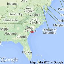
Pg. 11 (fig. 8), 19, 21, 29, 31 (fig. 22), 33. Shepherd Grove Formation. Occurs in subsurface of southern Dorchester County, southeastern South Carolina. Sediments previously included in the Black Creek Formation by Hazel and others (1977) and Gohn and others (1977). Consists mostly of gray-green, calcareous clays and silts. Thickness 110 feet at type. Overlies Middendorf Formation; underlies Caddin Formation (new). Age is Late Cretaceous (late Santonian to early Campanian; Austinian Provincial Age; DICARINELLA ASYMETRICA planktic foram zone, CALCULITES OBSCURUS to ASPIDOLITHUS PARCUS (NC17 to NC18) calcareous nannofossil zone, VEENIA QUADRIALIRA to ALATACYTHERE CHEETHAMI ostracode zone).
Type section (subsurface): depth-interval 1,644 to 1,754 ft, Clubhouse Crossroads No. 1 drill core, near Clubhouse Crossroads, Dorchester Co., southeastern SC. Named from Shepherd Grove Cemetery, about 3 mi north of drill site.
Source: Publication.
- Usage in publication:
-
- Shepherd Grove Formation*
- Modifications:
-
- Areal extent
- Biostratigraphic dating
- AAPG geologic province:
-
- Atlantic Coast basin
Summary:
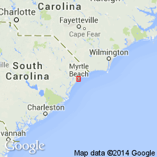
Shepherd Grove Formation extended northeastward where identified in Myrtle Beach, SC, corehole. Consists of 15 ft of grayish-olive-green, calcareous, silty and sandy clay overlying Middendorf Formation. Although lithologically similar to Middendorf, has significantly reduced faunal and floral diversity and abundance. Table 1 provides list of calcareous nannofossils and ostracodes.
Source: GNU records (USGS DDS-6; Reston GNULEX).
For more information, please contact Nancy Stamm, Geologic Names Committee Secretary.
Asterisk (*) indicates published by U.S. Geological Survey authors.
"No current usage" (†) implies that a name has been abandoned or has fallen into disuse. Former usage and, if known, replacement name given in parentheses ( ).
Slash (/) indicates name conflicts with nomenclatural guidelines (CSN, 1933; ACSN, 1961, 1970; NACSN, 1983, 2005, 2021). May be explained within brackets ([ ]).