The National Geologic Map Database is migrating to a new infrastructure. We apologize for any service disruptions during this process.
|
|---|


- Usage in publication:
-
- Shellstone Creek beds
- Modifications:
-
- First used
- Dominant lithology:
-
- Sand
- Chert
- AAPG geologic province:
-
- South Georgia sedimentary province
Summary:
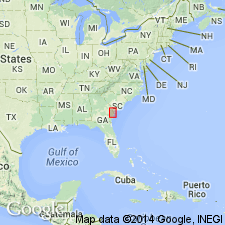
Shellstone Creek beds consisting of moderately weathered, chert-bearing, stratified, argillaceous, well-sorted, fine-grained sand are here informally named in Bleckley Co., southern GA. Beds have been positively identified only at three sites. The sites are described as reference sections: 1) a roadcut on southern valley wall of Shellstone Creek, Bleckley Co., 2) top of a steep-head, 0.5 mi southeast of the Kathleen Observation Tower in Oakey Woods Wildlife Management area, Houston Co., and 3) exposure in a ravine at the intersection of two dirt roads, also in the in Oakey Woods. The stratified argillaceous sands resemble those of the Dry Branch Formation. Deposits have previously been mapped as Ocala Limestone, Flint River Formation, Suwannee Limestone, or an unnamed unit. In eastern Houston Co., beds are approximately 40 ft thick and at Shellstone Creek, they are less than 20 ft thick. It is possible that these beds should be included in the Tobacco Road Sand of the Barnwell Group, which they overlie with sharp contact. They probably grade laterally southward into the Marianna and Glendon Limestones because all are Vicksburgian in age and locally they underlie Oligocene residuum. Early Oligocene age is based on a CLYPEASTER ROGERSI found in the bedded chert from the lower part of the Shellstone Creek.
Source: GNU records (USGS DDS-6; Reston GNULEX).
For more information, please contact Nancy Stamm, Geologic Names Committee Secretary.
Asterisk (*) indicates published by U.S. Geological Survey authors.
"No current usage" (†) implies that a name has been abandoned or has fallen into disuse. Former usage and, if known, replacement name given in parentheses ( ).
Slash (/) indicates name conflicts with nomenclatural guidelines (CSN, 1933; ACSN, 1961, 1970; NACSN, 1983, 2005, 2021). May be explained within brackets ([ ]).