The National Geologic Map Database is migrating to a new infrastructure. We apologize for any service disruptions during this process.
|
|---|


- Usage in publication:
-
- Sheeprock group
- Modifications:
-
- First used
- Dominant lithology:
-
- Quartzite
- Schist
- Graywacke
- Phyllite
- Conglomerate
- AAPG geologic province:
-
- Southern Rocky Mountain region
Summary:
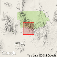
First published use as a group in the Sheeprock Range of northern Juab and southern Tooele Cos, UT. No type locality designated. Probably named for Sheeprock Canyon in T10S, R6W, Tooele Co, UT. Divided into Aut's Canyon and Ekker formations. Mapped (geologic map) in Juab and Tooele Cos., UT in the Southern Rocky Mountain region. Ekker does not extend south into Juab Co. Two crystalline highlands --one to the northwest and the other to the south --were the source areas for Sheeprock sediments. The group is 9,818 ft thick. Nine lettered units -A to I -of Aut's Canyon mapped. Lithologies common to the Aut's Canyon are quartzite, phyllite, and conglomerate. The Ekker has seven mapped units, lettered AA to GG. Lithologies common to the Ekker are quartzite, graywacke, and tillite. Aut's Canyon is the oldest unit mapped in the area. Intruded by the Tertiary Sheeprock granite stock. Is similar lithologically to the Big Cottonwood series. Correlation chart. Columnar sections of both formations. Precambrian age assigned.
Source: GNU records (USGS DDS-6; Denver GNULEX).
- Usage in publication:
-
- Sheeprock series
- Modifications:
-
- Named
- Dominant lithology:
-
- Slate
- Tillite
- Phyllite
- Quartzite
- AAPG geologic province:
-
- Southern Rocky Mountain region
- Great Basin province
Summary:
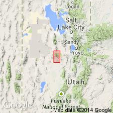
Name proposed for a 9,000 to 10,000 ft thick sequence of slate, tillite, quartzite, phyllite, and conglomerate in the Sheeprock Mountains, Tooele and Juab Cos., UT, in the Southern Rocky Mountain region. No type locality designated. Name proposed because correlation of this sequence with sequences in a similar stratigraphic position in other areas uncertain. At no place is base of Sheeprock exposed. Mapped (geologic map) south of the crest of range from the divide to the desert floor. Forms a variety of topographic forms from gentle to steep slopes to cliffs. Three parts described. Lower part consists of black-banded phyllite that is thinly banded to varved, fine grained at base and an overlying series of quartzites, conglomerates, a few slates. Lower part has an excellent marker 20 to 60 ft thick that is dark green and diabasic textured. The lower part is overlain by a tillite that varies from 0 to 4,000 ft thick named Dutch Peak tillite. The upper part is a 2,000 to 3,000 ft thick tan and green shale and white quartzite. Sheeprock was metamorphosed by the "Sheeprock granite". Cross section. Precambrian age.
Source: GNU records (USGS DDS-6; Denver GNULEX).
- Usage in publication:
-
- Sheeprock Group
- Modifications:
-
- Revised
- AAPG geologic province:
-
- Great Basin region
Summary:
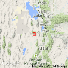
Sheeprock Group. In the Sheeprock Mountains of north-central Utah (Great Basin region), Sheeprock Formation raised in stratigraphic rank to Sheeprock Group. Divided into Otts Canyon (formerly spelled Auts Canyon), Dutch Peak Formation (formerly Dutch Peak Tillite), and Kelley Canyon Formation. Underlies Caddy Canyon Quartzite of Brigham Group. Age is Late Proterozoic. Report includes geologic map, stratigraphic charts.
Source: Modified from GNU records (USGS DDS-6; Denver GNULEX).
For more information, please contact Nancy Stamm, Geologic Names Committee Secretary.
Asterisk (*) indicates published by U.S. Geological Survey authors.
"No current usage" (†) implies that a name has been abandoned or has fallen into disuse. Former usage and, if known, replacement name given in parentheses ( ).
Slash (/) indicates name conflicts with nomenclatural guidelines (CSN, 1933; ACSN, 1961, 1970; NACSN, 1983, 2005, 2021). May be explained within brackets ([ ]).