

- Usage in publication:
-
- Shaver Intrusive Suite*
- Modifications:
-
- Named
- Dominant lithology:
-
- Granite
- Granodiorite
- AAPG geologic province:
-
- Sierra Nevada province
Summary:
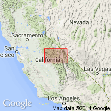
Named for exposures around Shaver Lake. Type area is Shaver Lake-Dinkey Dome area, east of Fine Gold Intrusive Suite [approx 37 deg to 37 deg 30'N, 118 deg 45' to 119 deg 30"W] central Sierra Nevada, CA. Previously called Shaver granitoid sequence (Stern and others, 1981). Consists of (older to younger) Dinkey Creek Granodiorite (new); granodiorite of McKinley Grove; Granodiorite of the Pick and Shovel mine area; granite of Ordinance Creek; granite of Shuteye Peak; Granites of Dinkey Dome, Short Hair Creek, Sheepthief Creek, lower Bear Creek, Mushroom Rock, and north of Snow Corral Meadow; and possible additional units of granodiorite of Whisky Ridge and Stevenson Creek. In two locations nested intrusions are successively younger and more leucocratic. Isotopic ages indicate approx temporal equivalence to intrusive suite of Yosemite Valley. Is Early Cretaceous age.
Source: GNU records (USGS DDS-6; Menlo GNULEX).
For more information, please contact Nancy Stamm, Geologic Names Committee Secretary.
Asterisk (*) indicates published by U.S. Geological Survey authors.
"No current usage" (†) implies that a name has been abandoned or has fallen into disuse. Former usage and, if known, replacement name given in parentheses ( ).
Slash (/) indicates name conflicts with nomenclatural guidelines (CSN, 1933; ACSN, 1961, 1970; NACSN, 1983, 2005, 2021). May be explained within brackets ([ ]).