- Usage in publication:
-
- Sharpsdale formation
- Modifications:
-
- Original reference
- Dominant lithology:
-
- Siltstone
- Sandstone
- Conglomerate
- Limestone
- AAPG geologic province:
-
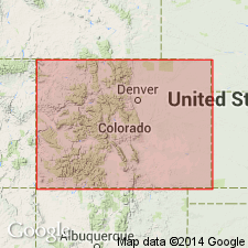
- Las Vegas-Raton basin
Summary:
Pg. 60 (fig. 1), 61, fig. 2. Sharpsdale formation. Was originally called Deer Creek formation by D.W. Bolyard (1956, 1956a) [see entry under Deer Creek], but that name is preoccupied. Sharpsdale is proposed as a replacement name; it is the nearest settlement and the only one in the township. Consists of red siltstones, sandstones, conglomerates, and limestones. Thickness up to 1,000+ feet. Underlies Madera formation. Overlies Precambrian rocks; locally overlies a few thin beds of Kerber formation. Fossils. Brill (1952) reported the occurrence of fusulinid FUSULINELLA DEVEXA Thompson from a limestone bed 653 feet above base of type section. Age is considered early Middle(?) Pennsylvanian (probably Atokan), although parts may be Morrowan or Desmoinesian.
Type section: along Huerfano River, in E/2 sec. 23 and NW/4 sec. 13, T. 27 S., R. 72 W., [Mosca Pass 7.5-min quadrangle], northeastern Huerfano Co., central southern CO, as described by D.W. Bolyard (1956, p. 116-125, 1956a, p. 52-53).
Named from Sharpsdale, [situated along Huerfano River near confluens with Manzanares Creek, in NW/4 NW/4 sec. 8, T. 27 S., R. 71 W., Lat. 37 deg. 43 min. 10 sec. N., Long. 105 deg. 21 min. 42 sec. W., Red Wing 7.5-min quadrangle, Huerfano Co., Sangre de Cristo Mountains, central southern CO.
[Additional locality information from USGS historical topographic map collection TopoView and USGS GNIS database, accessed Mother's Day 2018.]
References cited: D.W. Bolyard, 1956, Univ. Colorado unpub. MS thesis; D.W. Bolyard, 1956a, Permo-Pennsylvanian section at La Veta Pass, CO, Rocky Mtn. Geol. Raton Basin Gdbk.; and K.G. Brill, 1952, GSA Bull., v. 61, p. 809-880.
Source: Publication.
- Usage in publication:
-
- Sharpsdale formation
- Modifications:
-
- Areal extent
- AAPG geologic province:
-
- Las Vegas-Raton basin
Williamson, D.R., and Burgin, Lorraine, 1960, Limestone occurrences in Colorado: Colorado School of Mines Foundation, Mineral Industries Bulletin, v. 3, no. 1, p. __.
Summary:
Pg. 11 (chart), 12. Sharpsdale formation. About 400 feet of red-gray siltstone, sandstone, and conglomerate that contains several fossiliferous marine limestones. Transitional into overlying Madera formation; overlies Kerber formation. Age is Pennsylvanian.
Source: US geologic names lexicon (USGS Bull. 1200, p. 3551).
For more information, please contact Nancy Stamm, Geologic Names Committee Secretary.
Asterisk (*) indicates published by U.S. Geological Survey authors.
"No current usage" (†) implies that a name has been abandoned or has fallen into disuse. Former usage and, if known, replacement name given in parentheses ( ).
Slash (/) indicates name conflicts with nomenclatural guidelines (CSN, 1933; ACSN, 1961, 1970; NACSN, 1983, 2005, 2021). May be explained within brackets ([ ]).

