- Usage in publication:
-
- Sharpsboro Member
- Modifications:
-
- Original reference
- Dominant lithology:
-
- Limestone
- Dolomite
- AAPG geologic province:
-
- Ozark uplift
- Illinois basin
Summary:
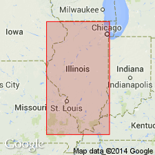
Pg. 13 (fig. 2), 36 (fig. 12), 55. Sharpsboro Member of Dutchtown Formation. Consists principally of argillaceous dark-brown and black lithographic to fine-grained dense limestone and dolomite that is somewhat silty and sandy at various intervals and is slightly oolitic. Some layers of lighter colored medium-grained limestone and medium-grained calcarenite present in lower part in type area. In Illinois, beds of light-colored sandy dolomite resembling overlying Joachim Formation present locally near top. Thickness 67 feet in well near Mound City, Pulaski County, Illinois; 105 feet in Midwest Dairy Company well at Cape Girardeau, Missouri; at type section, 10.5 feet. Overlies Gordonville Member. Equivalent to middle and upper Dutchtown members of McQueen (1937). Age is Middle Ordovician (Champlainian).
Type section: Geiser quarry on north side of State Highway 75, 1.25 mi east of Dutchtown, in SW/4 NW/4 [SW/4?] NW/4 sec. 20 (projected), T. 30 N., R. 13 E., Cape Girardeau quadrangle, Cape Girardeau Co., MO. Named from Sharpsboro on St. Louis-San Francisco RR, in Cape Girardeau Co., MO, 5.5 mi southeast of type section.
Source: US geologic names lexicon (USGS Bull. 1350, p. 683).
For more information, please contact Nancy Stamm, Geologic Names Committee Secretary.
Asterisk (*) indicates published by U.S. Geological Survey authors.
"No current usage" (†) implies that a name has been abandoned or has fallen into disuse. Former usage and, if known, replacement name given in parentheses ( ).
Slash (/) indicates name conflicts with nomenclatural guidelines (CSN, 1933; ACSN, 1961, 1970; NACSN, 1983, 2005, 2021). May be explained within brackets ([ ]).

