

- Usage in publication:
-
- Sharpners Pond Diorite*
- Modifications:
-
- Revised
- Redescribed
- Age modified
- Geochronologic dating
- Dominant lithology:
-
- Quartz diorite
- Diorite
- AAPG geologic province:
-
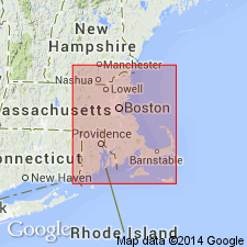
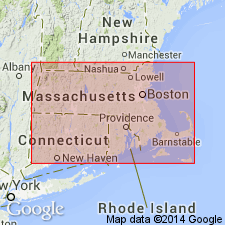
- New England province
Summary:
Renamed Sharpners Pond Diorite because compositional range, according to the Streckeisen (1973) classification, is quartz diorite to diorite. R.E. Zartman and R.S. Naylor (written commun., 1981) obtained a concordant U-Th-Pb age of about 430+/-5 m.y. on zircons from Sharpners Pond Diorite, placing it in the Silurian.
Source: GNU records (USGS DDS-6; Reston GNULEX).

- Usage in publication:
-
- Sharpners Pond Diorite*
- Modifications:
-
- Overview
- AAPG geologic province:
-
- New England province
Summary:
Used as Sharpners Pond Diorite of Silurian age. Intrudes Ordovician or Silurian Andover Granite, and Proterozoic Z or Ordovician Nashoba Formation and Fish Brook Gneiss.
Source: GNU records (USGS DDS-6; Reston GNULEX).
- Usage in publication:
-
- Sharpners Pond Diorite*
- Modifications:
-
- Overview
- Geochronologic dating
- AAPG geologic province:
-
- New England province
Summary:
Sharpners Pond Diorite covers an area of about 150 sq km. Includes diorite, tonalite, and small amounts of granodiorite. Intrudes Nashoba and Marlboro Formations, and older gneissic phase of Andover Granite. Intruded by pegmatites, younger phase of Andover Granite, and biotite granite. Age is Silurian based on reliable U-Pb zircon date of 430 +/-5 Ma (Zartman and Naylor, 1984). [Papers presented as chapters in U.S. Geological Survey Professional Paper 1366 are intended as explanations and (or) revisions to MA State bedrock geologic map of Zen and others (1983) at scale of 1:250,000.]
Source: GNU records (USGS DDS-6; Reston GNULEX).
- Usage in publication:
-
- Sharpners Pond Plutonic Suite
- Modifications:
-
- Revised
- Areal extent
- AAPG geologic province:
-
- New England province
Summary:
Unit referred to in this report as Sharpners Pond Plutonic Suite. Intrudes the metamorphic rocks of the Nashoba terrane in northeastern MA and extends from Wilmington (north of Boston) to the Atlantic coast, covering an area of about 300 square km. Divided into three different types of rocks: intermingled series with fine-grained gabbro mingled with biotite granites; intermediate rocks consisting of diorite to tonalite; and medium- to coarse-grained homogeneous cumulitic rocks, consisting of medium-grained gabbro through diorite. Intrudes felsic gneisses, the Fish Brook Gneiss, amphibolites, and metasediments of the Nashoba Formation. Age is Silurian.
Source: GNU records (USGS DDS-6; Reston GNULEX).
For more information, please contact Nancy Stamm, Geologic Names Committee Secretary.
Asterisk (*) indicates published by U.S. Geological Survey authors.
"No current usage" (†) implies that a name has been abandoned or has fallen into disuse. Former usage and, if known, replacement name given in parentheses ( ).
Slash (/) indicates name conflicts with nomenclatural guidelines (CSN, 1933; ACSN, 1961, 1970; NACSN, 1983, 2005, 2021). May be explained within brackets ([ ]).