- Usage in publication:
-
- Shark River marl
- Modifications:
-
- Named
- Dominant lithology:
-
- Marl
- Clay
- AAPG geologic province:
-
- Atlantic Coast basin
Summary:
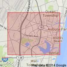
Shark River marl named, the bed of the oldest Eocene ocean. Consists of fossiliferous indurated clay with disseminated grains of greensand. Thickness unknown.
Source: GNU records (USGS DDS-6; Reston GNULEX).
- Usage in publication:
-
- Shark River marl*
- Modifications:
-
- Overview
- Dominant lithology:
-
- Greensand
- AAPG geologic province:
-
- Atlantic Coast basin
Summary:
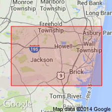
Shark River marl is a marked greensand with slight admixture of argillaceous materials, with usually a hardened stony layer at top. Thickness 12 ft. Eocene fossils. Typically developed in valley of Shark River. Overlain unconformably by Miocene [Kirkwood formation]. Rests conformably on Manasquan marl. [Later reports give thicknesses up to 19 ft.]
Source: GNU records (USGS DDS-6; Reston GNULEX).
- Usage in publication:
-
- Shark River Formation
- Modifications:
-
- Revised
- Biostratigraphic dating
- Overview
- Dominant lithology:
-
- Sand
- AAPG geologic province:
-
- Atlantic Coast basin
Summary:
The Shark River Formation, as redefined, is expanded to include the Squankum Member and a new unit, the Toms River Member, which is recognized only in the subsurface. The Squankum is an argillaceous, glauconite sand ranging in thickness from about 40 ft near outcrop to 20 ft or less in the subsurface. Typical Squankum exposures are limited to a few areas in Monmouth Co. The Squankum outcrop, Clark's (1894) type locality of the Shark River Formation, and the exposures along an unnamed tributary to Deal Lake, are the only exposures known to the writer. The upper member of the Shark River is restricted to the subsurface and is designated the Toms River Member from studies of core samples obtained from well no. 84 of the Toms River Chemical Company, Toms River, Ocean Co. It is micaceous, slightly clayey, slightly glauconitic, fine to medium-grained quartz sand. Thickness ranges from a feather edge to over 100 ft in a downdip direction.
Source: GNU records (USGS DDS-6; Reston GNULEX).
- Usage in publication:
-
- Shark River Formation*
- Modifications:
-
- Biostratigraphic dating
- Overview
- Dominant lithology:
-
- Clay
- Silt
- AAPG geologic province:
-
- Atlantic Coast basin
Summary:
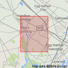
The Shark River Formation in the ACGS-4 corehole (Mays Landing, Atlantic Co.) has a sharp contact with the underlying Manasquan Formation and is approximately 132 ft thick. It is characterized by an abundance of clay and silt and the absence of clastic sand. According to the geochronology of Berggren and others (1985), the zone assignments (NP 14 to NP 18) indicate that the Shark River was deposited in the middle and late Eocene (late Lutetian, Bartonian, and early Priabonian) between approximately 51 and 39.5 Ma. Unit, in part, is equivalent to the Piney Point Formation (middle Eocene) of VA. (Use of Piney Point in NJ is discontinued in this report). The Shark River crops out only in the northern NJ Coastal Plain. Because of its poor exposure and small areal outcrop distribution, the Shark River is the least studied of all the outcropping formations in the NJ Coastal Plain.
Source: GNU records (USGS DDS-6; Reston GNULEX).
- Usage in publication:
-
- Shark River Formation*
- Modifications:
-
- Age modified
- Biostratigraphic dating
- AAPG geologic province:
-
- Atlantic Coast basin
Summary:
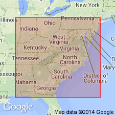
Shark River Formation found in Clayton core from south-central NJ. Bounded above and below by unconformities. Lower two-thirds corresponds to calcareous nannofossil Zones NP14 and NP15, but upper third correlation is uncertain. Age shown is early, middle, and possibly late Eocene.
Source: GNU records (USGS DDS-6; Reston GNULEX).
For more information, please contact Nancy Stamm, Geologic Names Committee Secretary.
Asterisk (*) indicates published by U.S. Geological Survey authors.
"No current usage" (†) implies that a name has been abandoned or has fallen into disuse. Former usage and, if known, replacement name given in parentheses ( ).
Slash (/) indicates name conflicts with nomenclatural guidelines (CSN, 1933; ACSN, 1961, 1970; NACSN, 1983, 2005, 2021). May be explained within brackets ([ ]).

