

- Usage in publication:
-
- Shainin Lake Member*
- Modifications:
-
- Named
- Dominant lithology:
-
- Conglomerate
- Sandstone
- AAPG geologic province:
-
- Alaska Northern region
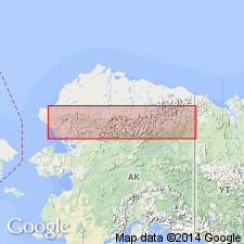
Summary:
Name proposed for the middle member (of 3) of Kanayut Conglomerate. Extends across most of eastern and central Brooks Range. Consists of fluvial conglomerate and sandstone as thick as 530 m. Gradationally overlies Ear Peak Member (new) of Kanayut Conglomerate. Gradationally underlies Stuver Member of Kanayut Conglomerate. Age is Late Devonian, on basis of its stratigraphic position.
Type section: measured on prominent cliff directly south of confluence of Kayak and Alapah Creeks about 8 km south-southeast of Shainin Lake, in sec. 4, T. 14 S., R. 5 E., Chandler Lake quadrangle, northern AK. Named from exposures several km south of Shainin Lake.
Source: Modified from GNU records (USGS DDS-6; Menlo GNULEX).
For more information, please contact Nancy Stamm, Geologic Names Committee Secretary.
Asterisk (*) indicates published by U.S. Geological Survey authors.
"No current usage" (†) implies that a name has been abandoned or has fallen into disuse. Former usage and, if known, replacement name given in parentheses ( ).
Slash (/) indicates name conflicts with nomenclatural guidelines (CSN, 1933; ACSN, 1961, 1970; NACSN, 1983, 2005, 2021). May be explained within brackets ([ ]).