- Usage in publication:
-
- Sexton Creek limestone
- Modifications:
-
- Named
- Dominant lithology:
-
- Limestone
- AAPG geologic province:
-
- Illinois basin
Summary:
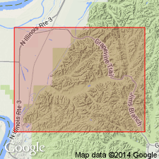
Named for exposures on Sexton Creek, Alexander Co., southwestern IL (Savage, 1909). Name assigned to limestones of Niagaran (Clinton) age in Alexander Co. Lower part contains thin layers of hard gray limestone interbedded with chert. Upper part contains thicker layers of pink or reddish, mottled, subcrystalline limestone. Thickness is 16 to 70 ft. Separated from underlying Edgewood limestone of Alexandrian series by 2-in. band or red residual clay. Unconformably underlies Devonian Helderbergian series.
Source: GNU records (USGS DDS-6; Reston GNULEX).

- Usage in publication:
-
- Sexton Creek Limestone
- Modifications:
-
- Overview
- AAPG geologic province:
-
- Illinois basin
Summary:
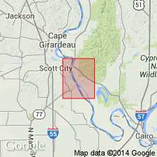
Sexton Creek Limestone overlies Edgewood Formation in southern IL. Although named for exposures in Mississippi River bluff at mouth of Sexton Creek, best exposed 4 mi northeast of type locality, just north of mouth of Dongola Hollow. Was originally defined to include higher strata, now differentiated as St. Clair Limestone, but was restricted to its present boundaries by Ulrich (1911). Locally truncates Edgewood Limestone to rest directly on Girardeau Limestone. Sexton Creek and its contact with Edgewood is exposed in roadcut 0.25 mi southeast of Gale. Formation is gray, fine-grained, thin-bedded limestone. Upper part is thicker bedded and is mottled red. In areas where relatively thick, Sexton Creek commonly contains persistent bands of black chert nodules. Correlates with Kankakee Formation of northern IL on basis of fossils, although faunal zones that mark top and bottom of Kankakee have not been found in the Sexton Creek. Approximately equivalent to Brassfield Limestone in Indiana and Kentucky. Age is Silurian (Alexandrian).
Source: GNU records (USGS DDS-6; Reston GNULEX).

- Usage in publication:
-
- Sexton Creek Limestone*
- Modifications:
-
- Overview
- AAPG geologic province:
-
- Illinois basin
Summary:
Sexton Creek Limestone mapped at surface in IL and consists of fine-grained to sublithographic limestone containing irregular nodules of brown chert. Overlies a major regional unconformity. Mapped undivided with Bailey Limestone and Bainbridge Formation in north-central part of quad where float indicates probable presence of all three formations, but outcrops are insufficient to differentiate the units. Mapped in subsurface of IL with Bainbridge Formation.
Source: GNU records (USGS DDS-6; Reston GNULEX).
For more information, please contact Nancy Stamm, Geologic Names Committee Secretary.
Asterisk (*) indicates published by U.S. Geological Survey authors.
"No current usage" (†) implies that a name has been abandoned or has fallen into disuse. Former usage and, if known, replacement name given in parentheses ( ).
Slash (/) indicates name conflicts with nomenclatural guidelines (CSN, 1933; ACSN, 1961, 1970; NACSN, 1983, 2005, 2021). May be explained within brackets ([ ]).

