- Usage in publication:
-
- Sevilleta rhyolite
- Modifications:
-
- Named
- Dominant lithology:
-
- Rhyolite
- AAPG geologic province:
-
- Southwestern Basin-and-Range region
Summary:
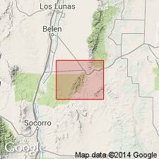
Named after old Sevilleta land grant in Socorro Co, NM, Southwestern Basin-and-Range region, within bounds of which rhyolite occurs. No type locality designated. Forms 5-mi-long belt, from 0.5 to 1.5 mi wide, south and southeast from Hwy 60 across Los Pinos Mountains. Base consists of 500 ft of more or less compact, sericitic rhyolite which varies from light buff to reddish brown. Groundmass is extremely fine-grained with a silky luster. Contains phenocrysts of pink orthoclase ranging from 1-15 mm in length. Basal part grades upward into progressively less-metamorphosed, dark-red to black rhyolite with phenocrysts of orthoclase and quartz. Thickness is 4,500 ft. Disconformably overlies pre-Cambrian White Ridge quartzite (new). Intruded by pre-Cambrian Los Pinos granite (new). Geologic map. Measured cross sections. Cross sections. Pre-Cambrian age [presumably based on regional geology and stratigraphic position].
Source: GNU records (USGS DDS-6; Denver GNULEX).

- Usage in publication:
-
- Sevilleta Rhyolite
- Modifications:
-
- Geochronologic dating
- AAPG geologic province:
-
- San Juan basin
Summary:
Pg. 25, geologic time scale (inside front cover). Sevilleta Rhyolite of Stark and Dapples (1946). Rhyolite sample from Los Pinos Mountains, [approx.] Lat. 34 deg. 28 min. N., Long. 106 deg. 30 min. W., Becker quadrangle, Valencia County, New Mexico, yielded a Pb-alpha age of 1,500 +/-250 Ma (zircon) [Precambrian X to Y]; reconnaissance age. Age calculated using decay constants of Steiger and Jager, 1977 (Earth Planet. Sci. Letters, v. 36, p. 359-362).
Source: Publication.
For more information, please contact Nancy Stamm, Geologic Names Committee Secretary.
Asterisk (*) indicates published by U.S. Geological Survey authors.
"No current usage" (†) implies that a name has been abandoned or has fallen into disuse. Former usage and, if known, replacement name given in parentheses ( ).
Slash (/) indicates name conflicts with nomenclatural guidelines (CSN, 1933; ACSN, 1961, 1970; NACSN, 1983, 2005, 2021). May be explained within brackets ([ ]).

