

- Usage in publication:
-
- Sevier River formation*
- Modifications:
-
- Named
- Dominant lithology:
-
- Conglomerate
- Sand
- Silt
- Diatomite
- AAPG geologic province:
-
- Wasatch uplift
Summary:
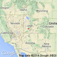
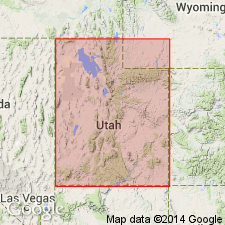
Named. Consists of a series of partly consolidated deposits exposed by dissection of pediments over an area of about 4 sq mi north of junction of Clear Creek and Sevier River, Sevier Co, UT on the Wasatch uplift. No type locality designated. Several smaller separated outcrop areas preserved by down-faulting in synclinal basin of Clear Creek, and in low hills west and southwest of Marysvale. Consists of fanglomerate, conglomerate, sand, and silt derived chiefly from rhyolitic tuffs and quartz latite flows of later Tertiary? age. The fanglomerate and conglomerate grade eastward into pinkish sand and silt which in turn grade into diatomite beds that were deposited in a lake. Thickness not stated. Neither upper or lower contact described. These deposits have been mapped as Tertiary and as part of Wasatch formation in earlier reports. The diatomite beds 2 mi north of Sevier yielded freshwater gastropods and diatoms of late Pliocene or early Pleistocene age.
Source: GNU records (USGS DDS-6; Denver GNULEX).
- Usage in publication:
-
- Sevier River Formation*
- Modifications:
-
- Areal extent
- AAPG geologic province:
-
- Great Basin province
- Wasatch uplift
Summary:
Term Parunuweap Formation abandoned in favor of Miocene, Pliocene, and Pleistocene Sevier River Formation. Sevier River Formation rarely exceeds a few hundred m in thickness of exposed rock. Base is rarely seen. Authors believe the Sevier River filled significant parts of the intermontane valleys of the southern High Plateaus. Correlation chart; block diagram; measured sections. Shown as present in Black Mountains, southern Tushar Mountains, Markagunt Plateau, and southern Sevier Plateau, in the High Plateaus of UT, Wasatch uplift and Great Basin province.
Source: GNU records (USGS DDS-6; Denver GNULEX).
- Usage in publication:
-
- Sevier River Formation*
- Modifications:
-
- Age modified
- AAPG geologic province:
-
- Wasatch uplift
Summary:
Consists in the Marysvale area, UT on the Wasatch uplift, of predominantly fluviatile and minor lacustrine sediments deposited in developing basins of the High Plateaus, Wasatch uplift, during the late Cenozoic. Sedimentation was concurrent with widespread basin-range faulting. Ash-fall tuffs and basalts interleaved with formation indicate episodic volcanism. Zr from tuff bed near base of formation yielded a fission-track age of 14.2 +/-0.9 m.y. Zr from near the eroded top yielded a fission-track age of 7.1 +/-0.7 m.y. These ages are Miocene.
Source: GNU records (USGS DDS-6; Denver GNULEX).
For more information, please contact Nancy Stamm, Geologic Names Committee Secretary.
Asterisk (*) indicates published by U.S. Geological Survey authors.
"No current usage" (†) implies that a name has been abandoned or has fallen into disuse. Former usage and, if known, replacement name given in parentheses ( ).
Slash (/) indicates name conflicts with nomenclatural guidelines (CSN, 1933; ACSN, 1961, 1970; NACSN, 1983, 2005, 2021). May be explained within brackets ([ ]).