The National Geologic Map Database is migrating to a new infrastructure. We apologize for any service disruptions during this process.
|
|---|


- Usage in publication:
-
- Severn formation
- Modifications:
-
- Named
- Dominant lithology:
-
- Sand
- AAPG geologic province:
-
- Atlantic Coast basin
Summary:
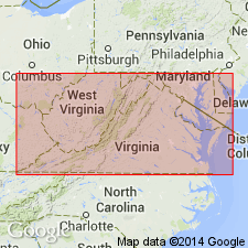
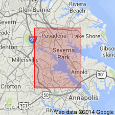
Severn formation named in eastern MD for the continuous southern extension of the NJ Cretaceous green sand series. It has not yet been determined whether it represents all or part of these members. In MD, it is a stratigraphic unit, distinctly separable from the NJ series as a whole by its homogeneity of constitution, and it is with this restriction that the term Severn is applied. Consists almost entirely of fine black sand, more or less flecked with scales of mica, very sparingly but irregularly glauconitic, and usually containing considerable carbonaceous materials. Thickness ranges from 10 to 100 ft. Exposed in high cliffs at Round Bay on Severn River. Unconformably underlies Pamunkey formation and unconformably overlies Potomac formation [group]. . [Unit was abandoned by the Geologic Names Committee on February 24, 1938, upon the recommendation of Stephenson, as the strata had by then been differentiated as in NJ.]
Source: GNU records (USGS DDS-6; Reston GNULEX).
- Usage in publication:
-
- Severn Formation*
- Modifications:
-
- Reinstated
- AAPG geologic province:
-
- Atlantic Coast basin
Summary:
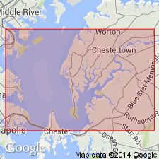
Severn Formation reinstated to replace entire Monmouth Formation (or Group) on western shore of Chesapeake Bay, MD, and to replace certain correlative units on MD eastern shore, extending into northern DE. These include upper part of Mount Laurel Sand (now stratigraphically restricted in MD and DE). Overlies Matawan Formation; underlies Brightseat or Aquia Formation. Age of Severn is Late Cretaceous (Maastrichtian).
Source: GNU records (USGS DDS-6; Reston GNULEX).
- Usage in publication:
-
- Severn Formation*
- Modifications:
-
- Biostratigraphic dating
- AAPG geologic province:
-
- Atlantic Coast basin
Summary:
Severn Formation shown as Late Cretaceous (late Maastrichtian) on fig. 1. Late Maastrichtian age based on CRASSATELLA VADOSA and BATHYTORMUS PTEROPSIS collected from Prince Georges Co., southern MD.
Source: GNU records (USGS DDS-6; Reston GNULEX).
- Usage in publication:
-
- Severn Formation
- Modifications:
-
- Overview
- AAPG geologic province:
-
- Atlantic Coast basin
Summary:
Two formations of Upper Cretaceous Monmouth Group occur in Ken-Bf 180: the Mount Laurel Formation and the Severn Formation. The Mount Laurel occupies the interval from 295 ft to 217.9 ft, while the Severn ranges from 217.9 to 204.2 ft. In Kent Co. the Mount Laurel ranges in thickness from about 25 ft to 80 ft, but unit is absent at Annapolis. Because the Severn Formation is thin and not easily distinguished its distribution is uncertain. It appears to be present throughout Kent Co. and composes the entire Monmouth Group at Annapolis. Biostratigraphic information from the core suggests that the Mount Laurel is Maastrichtian. Ostracode species recovered within the Severn at 210 ft range from late Campanian to Maastrichtian. Maastrichtian foraminiferal and palynomorph species are found at 214 ft. The Mount Laurel gradationally overlies the undivided Matawan Group and the Severn underlies the Hornerstown Formation.
Source: GNU records (USGS DDS-6; Reston GNULEX).
For more information, please contact Nancy Stamm, Geologic Names Committee Secretary.
Asterisk (*) indicates published by U.S. Geological Survey authors.
"No current usage" (†) implies that a name has been abandoned or has fallen into disuse. Former usage and, if known, replacement name given in parentheses ( ).
Slash (/) indicates name conflicts with nomenclatural guidelines (CSN, 1933; ACSN, 1961, 1970; NACSN, 1983, 2005, 2021). May be explained within brackets ([ ]).