

- Usage in publication:
-
- Seventy Six basalt*
- Modifications:
-
- Named
- Dominant lithology:
-
- Basalt
- AAPG geologic province:
-
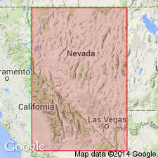
- Great Basin province
Summary:
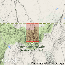
Pg. M8-M9, pI. 1 (geol. map). Seventy Six basalt. Black to dark-gray medium- to fine-grained porphyritic basalt. Labradorite phenocrysts make up 1 to 33 percent of rock; phenocrysts range in size from 0.5 to 6 inches. Occurs as sills, laccoliths, and slightly transgressive sheets, possibly also as flows. Sills are as little as 6 feet thick, but locally expand to laccolithic masses 200 feet thick. Intrudes Dead Horse tuff in masses along divide between Copper Basin and Seventy Six Creek and cuts Meadow Fork formation (new) in cirques southwest, northwest, and northeast of Marys River Peak. Does not intrude Danger Point tuff (new) or Jarbidge rhyolite. Age is late(?) Miocene, based on stratigraphic relationships. Adopted by the USGS.
Type locality: Seventy Six Creek, in southern part of Jarbidge quadrangle, Elko Co., northeastern NV. Named from Seventy Six Creek. Also exposed in Marys River Peak-Cougar Peak area in south-central part of quadrangle.
Source: US geologic names lexicon (USGS Bull. 1350, p. 679-680); supplemental information from GNU records (USGS DDS-6; Denver GNULEX).
- Usage in publication:
-
- Seventy Six Basalt*
- Modifications:
-
- Geochronologic dating
- AAPG geologic province:
-
- Great Basin province
Summary:
Seventy Six Basalt. Equivalent to a basaltic lapilli tuff of Rough Mountain, Elko County, Nevada, which has been dated at 22.9 +/-3 Ma (K-Ar, plagioclase). [Age is considered late Oligocene or early Miocene].
Source: Modified from GNU records (USGS DDS-6; Denver GNULEX).
For more information, please contact Nancy Stamm, Geologic Names Committee Secretary.
Asterisk (*) indicates published by U.S. Geological Survey authors.
"No current usage" (†) implies that a name has been abandoned or has fallen into disuse. Former usage and, if known, replacement name given in parentheses ( ).
Slash (/) indicates name conflicts with nomenclatural guidelines (CSN, 1933; ACSN, 1961, 1970; NACSN, 1983, 2005, 2021). May be explained within brackets ([ ]).