

- Usage in publication:
-
- Seven Rivers gypsiferous member*
- Modifications:
-
- Original reference
- Dominant lithology:
-
- Shale
- Limestone
- Breccia
- Gypsum
- AAPG geologic province:
-
- Permian basin
Summary:
Pg. 6-7, 13-15, and map. Seven Rivers gypsiferous member of Chupadera formation. The upper 60 feet or more consists of interbedded greenish limy shale and limestone, which in places changes laterally into limestone breccia; west of Atchison, Topeka and Santa Fe RR tracks the breccia becomes a persistent bed. Lower part of Seven Rivers member consists of an undeterminate thickness, but at least 100 feet, of thick beds of gypsum and associated red sand and shale. The Seven Rivers is basal member of Chupadera formation as exposed in Carlsbad region, where it underlies Carlsbad limestone member of the Chupadera. Age is Permian.
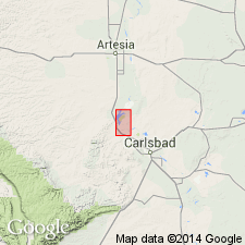
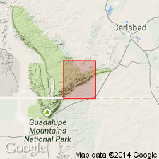
Named from exposures in bluffs south of Seven Rivers, notably in the bluff that lies in secs. 17 and 18 [?? 19 and 20], T. 20 S., R. 26 E., [Seven Rivers 7.5-min quadrangle, Eddy Co., southeastern NM].
Source: Publication; US geologic names lexicons (USGS Bull. 896, p. 1959; USGS Bull. 1200, p. 3530-3531).
- Usage in publication:
-
- Seven Rivers tongue*
- Modifications:
-
- Revised
- AAPG geologic province:
-
- Permian basin
Summary:
Seven Rivers tongue of Pecos formation. Underlies Carlsbad limestone tongue of Capitan limestone and is underlain by basal deposits of Pecos formation; in places it rests on Picacho limestone. [Age is Permian.]
[Pecos mapped in Eddy and Chaves Cos., NM.]
Source: US geologic names lexicon (USGS Bull. 896, p. 1959).
- Usage in publication:
-
- Seven Rivers gypsiferous member*
- Modifications:
-
- Revised
- AAPG geologic province:
-
- Permian basin
Summary:
[Lang made following changes: (1) divided the rocks formerly called Pecos formation into several formations (see under Pecos formation); (2) abandoned Pecos; (3) introduced Chalk Bluff formation for the beds overlying San Andres limestone member of Chupadera formation and underlying Castile anhydrite in Pecos Valley [southwestern New Mexico], where the Castile is only the upper attenuated part of the Castile of Delaware basin; (4) redfined Seven Rivers gypsiferous member by removing its upper part, which he named Three Twins member of Chalk Bluff formation; (5) showed Seven Rivers and Three Twins members as composing upper part of Chalk Bluff formation, the Seven Rivers resting on Queen sandstone member of Chalk Bluff formation; (6) introduced Azotea tongue of Carlsbad limestone for the tongue of limestone that separates the Seven Rivers and Three Twins members. This is present (ca. 1936) approved classification of the USGS.]
Source: US geologic names lexicon (USGS Bull. 896, p. 1959).
- Usage in publication:
-
- Seven Rivers formation*
- Modifications:
-
- Revised
- AAPG geologic province:
-
- Permian basin
Summary:
Pg. 9. Whitehorse group of West Texas and New Mexico is divided into (ascending) Grayburg, Queen, Seven Rivers, Yates, and Tansill formations. [Age is Late Permian (Guadalupe).]
Source: US geologic names lexicon (USGS Bull. 1200, p. 3530-3531).
- Usage in publication:
-
- Seven Rivers gypsiferous member*
- Seven Rivers formation*
- Modifications:
-
- Areal extent
- AAPG geologic province:
-
- Permian basin
Summary:
Pg. 67-68, 101 (fig. 12). Term Seven Rivers gypsiferous member of Chalk Bluff used for outcrop area of this report [suthern Guadalupe Mountains]; correlation chart shows Seven Rivers formation in subsurface in Midland basin. [Age is Late Permian (Guadalupe).]
Source: US geologic names lexicon (USGS Bull. 1200, p. 3530-3531).
- Usage in publication:
-
- Seven Rivers formation*
- Modifications:
-
- Areal extent
- AAPG geologic province:
-
- Permian basin
Summary:
Pg. 46. Carlsbad group comprises (ascending) Seven Rivers, Yates, and Tansill formations; in each of these are several laterally equivalent interfingering lithologic facies arranged in belts parallel to Capitan reef. Within a few miles of equivalent part of reef, the Seven Rivers consists of thin-bedded fine-grained white dolomite about 500 feet thick. In some areas, thin sandstones, which wedge out toward reef, are interbedded with the dolomites. Entire formation passes shelfward from dolomite to gypsum within a few miles. Tongue of fine-grained thin-bedded dolomite (Azotea) in upper part of formation extends several miles shelfward into red facies.
Source: US geologic names lexicon (USGS Bull. 1200, p. 3530-3531).
- Usage in publication:
-
- Seven Rivers formation*
- Modifications:
-
- Mapped
- AAPG geologic province:
-
- Permian basin
Summary:
Seven Rivers formation described in Carlsbad Cavern East quadrangle, New Mexico, where it is lowermost formation in Carlsbad group. Underlies Yates formation; grades laterally into Capitan limestone. [Age is Late Permian (Guadalupe).]
Source: US geologic names lexicon (USGS Bull. 1200, p. 3530-3531).
- Usage in publication:
-
- Seven Rivers limestone
- Modifications:
-
- Areal extent
- AAPG geologic province:
-
- Permian basin
Summary:
Seven Rivers limestone described in Wylie Mountains region, Texas, where it is youngest Paleozoic formation. Maximum thickness 160 feet. Overlies Victorio Peak formation; unconformable below Cretaceous Cox sandstone. [Age is Late Permian (Guadalupe).]
Source: US geologic names lexicon (USGS Bull. 1200, p. 3530-3531).
- Usage in publication:
-
- Seven Rivers formation*
- Modifications:
-
- Mapped
- AAPG geologic province:
-
- Permian basin
Summary:
Seven Rivers formation. Described in Carlsbad West quadrangle, New Mexico-Texas. Basal formation of Carlsbad group. Formation present at surface in broad outcrop band, in numerous nearby outliers, and in one inlier in northwest part of quadrangle. Conformably overlain by Yates formation. Seven Rivers grades laterally into lower part of Capitan limestone of Delaware basin margin area. In stratigraphically higher beds this facies change takes place progressively to southeast. Individual beds thicken considerably and change from dolomite to limestone within horizontal distance of several hundred feet. A little northwest of gradation between Capitan and Seven Rivers, another lateral gradation from predominant dolomite to predominant gypsum occurs within Seven Rivers. This takes place in and near Johnson Canyon. Within limits of this report gypsiferous facies contains high percentage of dolomite, but percentage of dolomite decreases in northwesterly direction. Thickness 460 feet in Bear Canyon. [Age is Late Permian (Guadalupe).]
Source: US geologic names lexicon (USGS Bull. 1200, p. 3530-3531).
- Usage in publication:
-
- Seven Rivers Formation
- Modifications:
-
- Revised
- Reference
- Dominant lithology:
-
- Anhydrite
- Shale
- Dolomite
- Siltstone
- Sandstone
- AAPG geologic province:
-
- Permian basin
Summary:
Designated as the middle formation of five formations of the newly named Artesia Group in Eddy Co, NM in Permian basin. Name Artesia applied to a sequence of shelf rocks. Overlies Queen Formation of Artesia. Underlies Yates Formation of Artesia. Reference well selected as the Humble Oil and Refining Co., Federal Bogle No. 1 in sec 30, T16S, R30E in Eddy Co where the Seven Rivers lies between 1,405 and 1,970 ft and is composed of anhydrite and interbeds of shale, dolomite, siltstone, and sandstone. Individual sandstone beds can be traced great distances. Cross sections. Correlation chart. Geologic map. Of late Guadalupian, Late Permian age.
Source: GNU records (USGS DDS-6; Denver GNULEX).

- Usage in publication:
-
- Seven Rivers formation*
- Modifications:
-
- Overview
- AAPG geologic province:
-
- Permian basin
Summary:
Seven Rivers Formation of Artesia Group adopted by the USGS. Terms Carlsbad Group and Chalk Bluff Formation abandoned; replaced by Artesia Group (D.B. Tait and others, 1962, AAPG Bull., v. 46, no. 4). Age is Late Permian (Guadalupe).
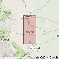
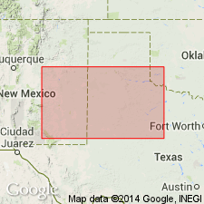
Named from exposures in bluffs south of Seven Rivers, notably bluff that lies in secs. 17 and 18, T. 20 S., R. 26 E., Eddy Co., NM. Recognized in southeastern NM and western TX.
Source: US geologic names lexicon (USGS Bull. 1200, p. 3530-3531).
For more information, please contact Nancy Stamm, Geologic Names Committee Secretary.
Asterisk (*) indicates published by U.S. Geological Survey authors.
"No current usage" (†) implies that a name has been abandoned or has fallen into disuse. Former usage and, if known, replacement name given in parentheses ( ).
Slash (/) indicates name conflicts with nomenclatural guidelines (CSN, 1933; ACSN, 1961, 1970; NACSN, 1983, 2005, 2021). May be explained within brackets ([ ]).