The National Geologic Map Database is migrating to a new infrastructure. We apologize for any service disruptions during this process.
|
|---|


- Usage in publication:
-
- Seven Devils Group*
- Modifications:
-
- Revised
- AAPG geologic province:
-
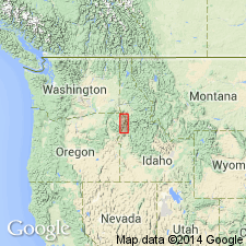
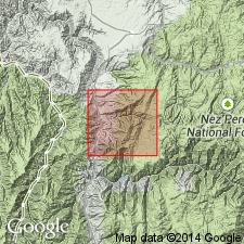
- Idaho Mountains province
- Snake River basin
- Eastern Columbia basin
Summary:
Divided into the newly named: 1) Windy Ridge Formation of Early Permian? age at base; 2) Hunsaker Creek Formation of Early Permian, Leonardian or early Guadalupian age; 3) Wild Sheep Creek Formation of Middle (Ladinian) and Late (Karnian) Triassic age; and 4) Doyle Creek Formation of Late (Norian) Triassic age. Kurry Creek Member named as upper member of Doyle Creek Formation near Pittsburgh Landing, west of Whitebird, Idaho Co, ID, Idaho Mountains province. [Relationship of new member to rest of Doyle Creek not stated.] Occurs also in Snake River and in Eastern Columbia basins. Correlated with Clover Creek Greenstone. Geologic map. Stratigraphic column.
Source: GNU records (USGS DDS-6; Denver GNULEX).
- Usage in publication:
-
- Seven Devils Group*
- Modifications:
-
- Areal extent
- AAPG geologic province:
-
- Idaho Mountains province
Summary:
Seven Devils divisible into two map units: 1) Hunsaker Creek (Early Permian) or Windy Ridge (Early Permian?) Formation; and 2) Doyle Creek Formation (Late Triassic) in a small area on east side of Salmon River; is not divisible on west side of Salmon River. These areas are in Idaho Co, ID, Idaho Mountains province, where they are part of the Wallowa terrane. Medium- and high-grade metamorphosed volcanic rocks east of the Salmon River area mapped as metamorphic units whose relative age and correlation are unknown; these rocks are tentatively correlated with the Seven Devils; they are shown as Permian and Triassic age; these rocks are also mapped as part of the Wallowa terrane; some are in the Rapid River plate and some are in the North Fork plate. These metamorphosed rocks were previously assigned to the Riggins Group. The Riggins and its component formations are not recognized in the area of this study. Upper contact of Doyle Creek with Martin Bridge Formation (revised, redescribed) gradational. Lower part intruded by a gneissic quartz diorite pluton which has an emplacement age of 259 Ma.
Source: Modified from GNU records (USGS DDS-6; Denver GNULEX).
For more information, please contact Nancy Stamm, Geologic Names Committee Secretary.
Asterisk (*) indicates published by U.S. Geological Survey authors.
"No current usage" (†) implies that a name has been abandoned or has fallen into disuse. Former usage and, if known, replacement name given in parentheses ( ).
Slash (/) indicates name conflicts with nomenclatural guidelines (CSN, 1933; ACSN, 1961, 1970; NACSN, 1983, 2005, 2021). May be explained within brackets ([ ]).