The National Geologic Map Database is migrating to a new infrastructure. We apologize for any service disruptions during this process.
|
|---|


- Usage in publication:
-
- Servilleta formation
- Modifications:
-
- First used
- Dominant lithology:
-
- Basalt
- Gravel
- Sand
- Clay
- AAPG geologic province:
-
- San Luis basin
- San Juan basin
Summary:
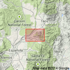
First published use of name (named in thesis by Butler, 1946); intent to name not stated; origin of name not given (probably named from Servilleta, Taos Co, NM). No type locality designated. Unconformably overlies Santa Fe formation and Picuris tuff north of northeast and north-central borders of Picuris Range, Taos Co, NM, San Luis basin. Servilleta consists of nearly horizontal alluvial beds with prominent, interlayered flows of basalt. Gravels and basalt flows of unit are also down-faulted against Santa Fe beds north of northeast border of Picuris Range and near Pilar; near Rinconada and Embudo (Taos and Rio Arriba Cos, San Luis and San Juan basins) thick beds of buff-colored sand and clay of unit are faulted against Santa Fe beds. An isolated patch of nearly horizontal basalt, interlayered with sand and gravel, unconformably overlies Picuris tuff north of Vadito and village of Rio Pueblo--this is almost certainly Servilleta. Unit's basalt flows adjacent to Picuris Range typically about 50 ft thick. Only one such flow is evident northeast of Pilar in exposures of Servilleta beds closest to range, but several such flows exposed along gorge of Rio Grande slightly to north. Gravels of unit distinguished by abundant layers of micaceous sand and much limonite. In area north of Picuris Range at least 1,500 ft of these beds present along Rio Grande and near Embudo. Late Pliocene or earliest Pleistocene age. Geologic map, sections.
Source: GNU records (USGS DDS-6; Denver GNULEX).
- Usage in publication:
-
- Servilleta Formation
- Modifications:
-
- Revised
- AAPG geologic province:
-
- San Luis basin
Summary:
Revised in the San Luis Hills of Conejos and Costilla Cos, CO in San Luis basin in that a new member--Mesita Member--named. After the San Luis Hills eroded to mature topography (after Conejos time) basalts of Servilleta flooded the margins of the hills. The flows are predominantly olivine-tholeiite basalts in which olivine is altered to iddingsite. The olivine, plagioclase, and clinopyroxene are coarse grained and closely spaced but with angular cavities between feldspar laths of random orientation. A typical diktytaxitic texture produced. This texture makes the formation easy to recognize in the field. Locally erupted andesitic rocks from the Mesita Crater and Volcano de La Culebra that formed small hills above the basalts belong to the Mesita Member. Geologic map. Of late Pliocene age.
Source: GNU records (USGS DDS-6; Denver GNULEX).
- Usage in publication:
-
- Servilleta Formation*
- Modifications:
-
- Areal extent
- AAPG geologic province:
-
- San Luis basin
Summary:
Extended into Conejos County, Colorado (San Luis basin). Present in vicinity of Antonito and Ortiz. Age is Pliocene, 3.6 to 4.5 Ma.
Source: Modified from GNU records (USGS DDS-6; Denver GNULEX).
- Usage in publication:
-
- Servilleta Formation*
- Modifications:
-
- Geochronologic dating
- AAPG geologic province:
-
- San Juan basin
- San Luis basin
Summary:
Servilleta Formation. Basalt sample from Black Mesa, Lyden quadrangle, Rio Arriba County, New Mexico, where Servilleta overlies Chamita Formation of Galusha and Blick (1971), yielded a K-Ar age of 2.78 +/-0.44 Ma (whole-rock), thus extending time of volcanism (previously reported 4.5 to 3.6 Ma by Ozima and others, 1967). Sample from isolated flow, mapped as part of Servilleta by Miller and others (1963), in Tres Ritos quadrangle, Taos County, New Mexico, yielded a K-Ar age of 5.11 +/-0.84 Ma (whole-rock). Age and petrology of flow are sufficiently different from Servilleta flows that it may be better related to the feldspathoidal basalts of Pliocene to Holocene age on the High Plains (Lipman and Mehnert, 1975).
Source: Modified from GNU records (USGS DDS-6; Denver GNULEX).
- Usage in publication:
-
- Servilleta Basalt*
- Modifications:
-
- Revised
- Redescribed
- Overview
- Areal extent
- Geochronologic dating
- Dominant lithology:
-
- Basalt
- AAPG geologic province:
-
- San Luis basin
Summary:
Distinctive flows of coarse-grained, diktytaxitic olivine tholeiite--which constitute the most voluminous and widespread rock type of the Taos Plateau volcanic field, Taos Co, north-central NM in San Luis basin--have previously been included in Servilleta Formation, along with interlayered nonvolcanic sedimentary rocks. Because regional stratigraphic relations and radiometric ages indicate that these interlayered sedimentary rocks are correlative with lithologically similar named units of the Santa Fe Group, such as Ancha Formation (Manley, 1978), the Servilleta is here revised and redescribed as Servilleta Basalt and includes only the distinctive olivine tholeiite flows which have always been its dominant constituent. Should not include upper gravel member (Lambert, 1966), as these deposits are of unrelated lithology and genesis. Recognized as far north as Alamosa, CO, San Luis basin, in wells in San Luis Valley, and as far south as Black Mesa. Depositional environment discussed. New K-Ar whole-rock dates on basalt in Servilleta yielded ages of: 3.35 +/-1.48 and 3.75 +/-0.77; one other age, on plagioclase, yielded anomolously old age of 8.55 +/-2.04 (probably due to argon retention).
Source: GNU records (USGS DDS-6; Denver GNULEX).
- Usage in publication:
-
- Servilleta Formation*
- Modifications:
-
- Mapped 1:50k (Conejos and Costilla Cos, CO)
- Geochronologic dating
- Dominant lithology:
-
- Basalt
- AAPG geologic province:
-
- San Luis basin
Summary:
Is a Pliocene formation mapped in eastern Conejos and western Costilla Cos, CO (San Luis basin). Outcrops in northeastern, east-central edge, southeastern edge, south-central, and southwestern parts of map area. Map unit described as thin flows of tholeiitic basalt characterized by small olivine phenocrysts, diktytaxitic texture, and local vesicle pipes and segregation veins. [Referred to as Servilleta Formation rather than Servilleta Basalt.] K-Ar age of flow in slump block in southeast corner of map is 4.3 Ma; ages of flows southeast of map area range from 3.6-4.5 Ma (K-Ar ages from other workers). Overlies Hinsdale Formation (Oligocene); underlies Quaternary surficial deposits; correlates with andesite of Mesita Hill (Pliocene?) and olivine andesite (Pliocene) map units. Maximum exposed thickness is about 50 m in Rio Grande gorge in south-central part of map area.
Source: GNU records (USGS DDS-6; Denver GNULEX).
For more information, please contact Nancy Stamm, Geologic Names Committee Secretary.
Asterisk (*) indicates published by U.S. Geological Survey authors.
"No current usage" (†) implies that a name has been abandoned or has fallen into disuse. Former usage and, if known, replacement name given in parentheses ( ).
Slash (/) indicates name conflicts with nomenclatural guidelines (CSN, 1933; ACSN, 1961, 1970; NACSN, 1983, 2005, 2021). May be explained within brackets ([ ]).